


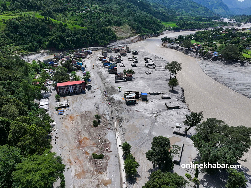
Government to map land damage from Rasuwa flood
Translated from English and summarized by DistantNews. Read the original for the full story.
At a glance
News
Sources not specified
New plan
- The Nepali government will map land damage caused by the Bhotekoshi flood in Rasuwa.
- Ministries of Land Management and Federal Affairs will collect data on affected private and public lands.
- The Department of Survey will be assigned to carry out the mapping.
The Nepali government has decided to undertake a comprehensive mapping of land damage resulting from the recent Bhotekoshi flood in the Rasuwa district. This initiative aims to assess the full extent of the impact on both private properties and public infrastructure.
Two key ministries are spearheading this effort: the Ministry of Land Management, Cooperatives and Poverty Alleviation, and the Ministry of Federal Affairs and General Administration. They will collaborate to gather detailed information on the affected areas. A high-level management group within these ministries made the decision to assign the task to the Department of Survey.
The mapping process is crucial for understanding the scale of the disaster and for planning future recovery and reconstruction efforts. By documenting the precise nature and location of the damage, authorities can better allocate resources and support to the affected communities in Rasuwa.
About this summary
Originally published by OnlineKhabar English in English. Translated, summarized, and contextualized automatically by DistantNews, with a note on how the source frames the story. Not individually reviewed before publishing. How this works.
More Stories


From Our Blog

What Gets Lost (and Found) When News Is Translated

The Critical Role of Diaspora Media in Global News

What Travellers Should Know About Countries with Restricted Press

A Digital Nomad's Guide to Following Local News

How the Same Story Looks Different in Different Countries
