


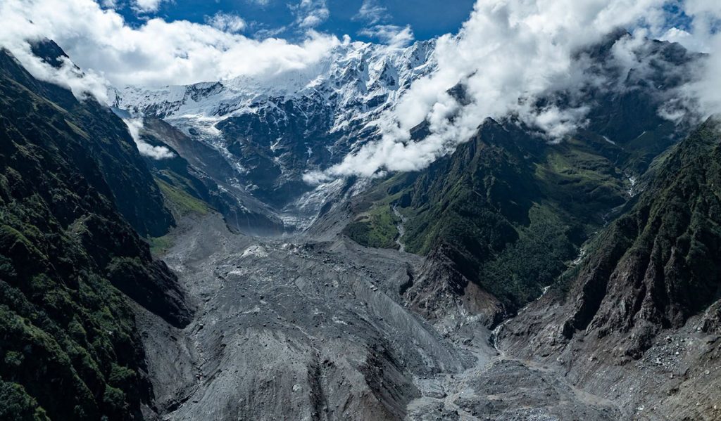
Langtang Lirung glacier was moving unusually fast before Bhotekoshi flood, Chinese study finds
Summarized by DistantNews. Read the original for the full story.
At a glance
News
Documents & data
Ongoing story
- A preliminary Chinese study found unusually rapid movement in the upper and middle sections of Nepal’s Langtang Lirung glacier during the past two years.
- Satellite and seismic data indicated activity before the disaster, but researchers said there was not enough evidence to call it a definite warning sign.
- The study found that an ice-rock avalanche grew into a more destructive flood as it absorbed river water, soil, sediment and loose material downstream.
The Langtang Lirung glacier’s upper and middle sections moved unusually quickly in recent years, according to a preliminary study by China’s Institute of Tibetan Plateau Research.
Researchers with the Chinese Academy of Sciences analysed Sentinel-2 satellite imagery and detected unusual glacier movement and changes in the slope over the past two years. They said cracks may have formed in the ice and that parts of the slope may have become increasingly unstable. But the study does not conclude that the movement definitively warned of the disaster.
The researchers identified unusual seismic signals at about 6:04 a.m., 6:50 a.m. and between 8:15 and 8:19 a.m. Nepal time. Some coincided with reports from people in the area about landslide and dust activity. The findings suggest that smaller ice-rock movements may have started before the main event, rather than one sudden landslide causing everything at once.
The amount of ice and rock that initially fell was not the main factor determining the final scale of the disaster.
The Chinese Academy of Sciences also said the event could not be explained simply as a conventional landslide or avalanche. An ice-rock avalanche fell from Langtang Lirung at an elevation of about 5,200 metres and caused greater destruction downstream than at the initial impact site.
As the mass travelled toward Rasuwagadhi and Betrawati, it gathered river water, soil, sediment and other loose material. The material increased the flood’s volume and destructive force over roughly 22 kilometres. The study therefore focuses not only on the initial size of the avalanche, but also on the additional material it absorbed along its path. Researchers used satellite imagery, seismic data and weather information to examine how the high-Himalayan ice-rock avalanche transformed into a destructive flood.
The disaster grew progressively as soil, sediment, river water and unstable material from the riverbanks were incorporated along the way.
About this summary
Originally published by OnlineKhabar English. Summarized and contextualized automatically by DistantNews, with a note on how the source frames the story. Not individually reviewed before publishing. How this works.
More Stories


From Our Blog

What Gets Lost (and Found) When News Is Translated

The Critical Role of Diaspora Media in Global News

What Travellers Should Know About Countries with Restricted Press

A Digital Nomad's Guide to Following Local News

How the Same Story Looks Different in Different Countries
