


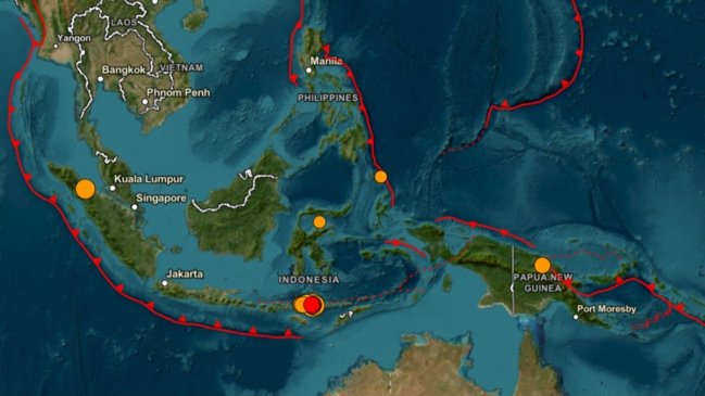
Magnitude 6.9 earthquake shakes Sumatra, second to hit Indonesia Saturday
Translated from Spanish, summarized and contextualized by DistantNews.
At a glance
News
Named sources
New plan
- A magnitude 6.9 earthquake struck northern Indonesia on Saturday, hours after a 7.7 magnitude quake hit the eastern part of the archipelago.
- The latest tremor occurred at a depth of 183 kilometers, with no immediate reports of casualties or damage, and no tsunami alert issued.
- Indonesia is located on the Pacific Ring of Fire, an area prone to frequent and significant seismic activity.
A magnitude 6.9 earthquake jolted northern Indonesia on Saturday, the U.S. Geological Survey reported. This tremor followed a stronger 7.7 magnitude quake that struck the eastern part of the archipelago earlier the same day.
The earthquake occurred at 10:54 GMT at a depth of 183 kilometers. Authorities have not reported any casualties or material damage, and no tsunami alert has been activated. The closest urban center to the epicenter is Pematangsiantar, a city of about 270,000 people, located less than ten kilometers away.
The earlier earthquake on the island of Flores, east of the archipelago, resulted in 38 deaths and 2,000 evacuations. Search and rescue operations are ongoing.
Indonesia lies within the "Pacific Ring of Fire," a region characterized by intense seismic and volcanic activity due to the convergence of tectonic plates. The nation, comprising over 17,000 islands, frequently experiences major earthquakes. A devastating 2004 earthquake off Sumatra triggered a tsunami that claimed over 226,000 lives across a dozen Indian Ocean nations.
DistantNews Editorial
Originally published by Cooperativa in Spanish. Translated, summarized, and contextualized by our editorial team with added local perspective. Read our editorial standards.
More Stories



From Our Blog

What Gets Lost (and Found) When News Is Translated

The Critical Role of Diaspora Media in Global News

What Travellers Should Know About Countries with Restricted Press

A Digital Nomad's Guide to Following Local News

How the Same Story Looks Different in Different Countries
