


Nepal-China border floods kill at least 160, with 668 missing; glacier collapse suspected
Translated from Korean and summarized by DistantNews. Read the original for the full story.
At a glance
News
From a news agency
Ongoing story
- At least 160 people have died and 668 are missing following a massive flood in the Himalayas bordering Nepal and China's Tibet region.
- The flood, possibly triggered by a glacier collapse, has destroyed roads, communication lines, and power, hindering rescue operations.
- Among the missing are nine South Korean workers involved in a hydropower project in Nepal.
A devastating flood in the Himalayan border region between Nepal and China's Tibet Autonomous Region has resulted in at least 160 confirmed deaths and 668 people missing. The disaster struck on August 26th, and rescue and recovery efforts are facing significant challenges due to extensive damage to infrastructure, including roads, communication networks, and power supplies. Officials fear the number of casualties will continue to climb.
In Nepal, 157 bodies have been recovered, with 403 individuals still unaccounted for. A significant portion of the missing, 341 people, are foreign nationals. Notably, nine South Korean employees of Korea South-East Power and Doosan Enerbility, who were working on a hydropower project in Nepal's Rasuwa district, are among those missing. Chinese authorities reported three deaths and 265 people missing in Tibet's Gyirong County.
The ground shook, and I thought it was an earthquake, but when I came out, a giant wall of water rushed in like a volcano erupting.
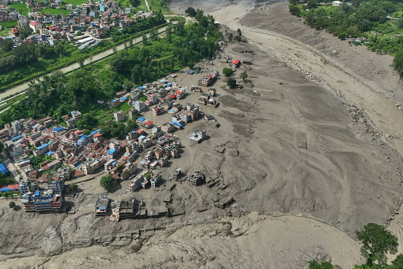
Rajendra Dhungana, a customs chief in the Nepalese border town of Timure, described the terrifying moment the floodwaters struck. "The ground shook, and I thought it was an earthquake, but when I came out, a giant wall of water rushed in like a volcano erupting," he told local media. The torrent of mud and rocks swept through the valley, engulfing the village and carrying away over 300 vehicles near the customs office.
The event was caused by a glacial collapse and subsequent debris flow, which caused a chain reaction of catastrophic impacts downstream.
Initial analyses suggest the flood was triggered not by an earthquake-induced landslide, but by a glacier collapse. The U.S. Geological Survey (USGS) reclassified the seismic event from a magnitude 4.4 earthquake to a magnitude 5.2 glacial collapse. Experts from the International Centre for Integrated Mountain Development (ICIMOD) observed a dramatic rise in water levels in the Trishuli River, surging up to 9 meters in just 30 minutes before and after the flood. Dan Shugar, a glaciologist from the University of Calgary, analyzed satellite imagery and concluded that a section of glacier at an altitude of approximately 5,200 meters broke off and fell into the valley below. This created a temporary "debris lake" by damming the river, which eventually burst, releasing a massive volume of water downstream.
Rescue operations are severely hampered. Nepal has lost at least 19 bridges and about 40 kilometers of roads. In some areas, floodwaters are too dangerous for rescue helicopters to land. China's Tibet Autonomous Region has also reported a complete cutoff of road, communication, and power links to the Gyirong border crossing. Chinese military helicopters have been deployed to assess the damage and secure routes for rescue efforts.
The bottom of the glacier at an altitude of about 5,200 meters broke off and fell about 1,200 meters to the valley floor.
About this summary
Originally published by Dong-A Ilbo in Korean. Translated, summarized, and contextualized automatically by DistantNews, with a note on how the source frames the story. Not individually reviewed before publishing. How this works.
More Stories


From Our Blog

What Gets Lost (and Found) When News Is Translated

The Critical Role of Diaspora Media in Global News

What Travellers Should Know About Countries with Restricted Press

A Digital Nomad's Guide to Following Local News

How the Same Story Looks Different in Different Countries
