

On the Trail of Glaciers That Covered the Carpathians: Spectacular Traces of Ice Ages in Romania
Translated from Romanian, summarized and contextualized by DistantNews.
TLDR
- Romania's Carpathian Mountains, particularly the Retezat, Făgăraș, Parâng, and Rodnei massifs, bear spectacular evidence of ancient glaciations.
- Scientists have identified over 500 glacial cirques in the Southern Carpathians, with glaciers once extending down to altitudes of 700-1000 meters.
- The Retezat massif hosted the longest glacier in the Carpathians, stretching 18 kilometers, with its moraines found at altitudes as low as 1,035 meters.
The majestic Carpathian Mountains, a jewel of Romania, stand as a testament to the powerful forces of nature that shaped our land over millennia. The Retezat, Făgăraș, Parâng, and Rodnei massifs, in particular, offer breathtaking landscapes sculpted by ancient glaciers, a spectacle that continues to awe visitors and scientists alike.
In the Southern Carpathians, the Făgăraș and Retezat massifs have the most extensive subalpine and alpine domains, situated above 1,800 m altitude, with 238 square kilometers and 116 square kilometers, respectively, while the other massifs (Parâng, Bucegi, Iezer–Păpușa etc.) have smaller areas of less than 75 square kilometers.
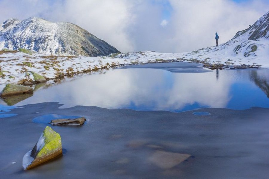
Our scientists have meticulously documented the profound impact of these ice ages, identifying over 500 glacial cirques in the Southern Carpathians alone. These formations, along with deep glacial valleys and stunning alpine lakes, paint a vivid picture of a bygone era. It's a reminder of the dynamic geological history embedded within our very soil, a heritage we cherish and study.
The Retezat massif, a crown jewel of our natural heritage, once cradled the longest glacier in the Carpathians, an immense river of ice that carved its path for 18 kilometers. The remnants of this glacial power, visible in the moraines found at surprisingly low altitudes, offer tangible proof of the dramatic climate shifts our planet has undergone.
The lowest moraines (deposits of stones, sand, and boulders transported by glaciers) that can be identified in the Retezat Massif are located at an altitude of 1,060 meters on the southern slope (Valea Lăpușnicului Mare) and at an altitude of 1,035 meters on the northern slope (Pietrele–Nucșoara glacial complex).
These spectacular glacial features are not just geological curiosities; they are integral to Romania's natural identity and a source of national pride. They draw researchers and nature enthusiasts, underscoring the importance of preserving these unique landscapes for future generations. While international coverage might focus on the scientific data, for us, it's about the enduring beauty and the deep connection to our land's ancient past.
They were deposited by glaciers that reached maximum lengths of 18 kilometers (Lăpușnicul Mare was the longest glacier in Retezat) and 7 kilometers on the northern side.
DistantNews Editorial
Originally published by Adevărul in Romanian. Translated, summarized, and contextualized by our editorial team with added local perspective. Read our editorial standards.
More Stories



From Our Blog

What Gets Lost (and Found) When News Is Translated

The Critical Role of Diaspora Media in Global News

What Travellers Should Know About Countries with Restricted Press

A Digital Nomad's Guide to Following Local News

How the Same Story Looks Different in Different Countries
