


South Korea braces for continued heavy rainfall, warns of safety hazards
Translated from Korean, summarized and contextualized by DistantNews.
At a glance
News
Sources not specified
Ongoing story
- Heavy rainfall is expected to continue across South Korea, with some areas receiving over 100mm per hour.
- The Meteorological Administration warns of potential safety hazards like landslides and floods.
- High temperatures are also forecast for some regions, increasing the risk of localized downpours.
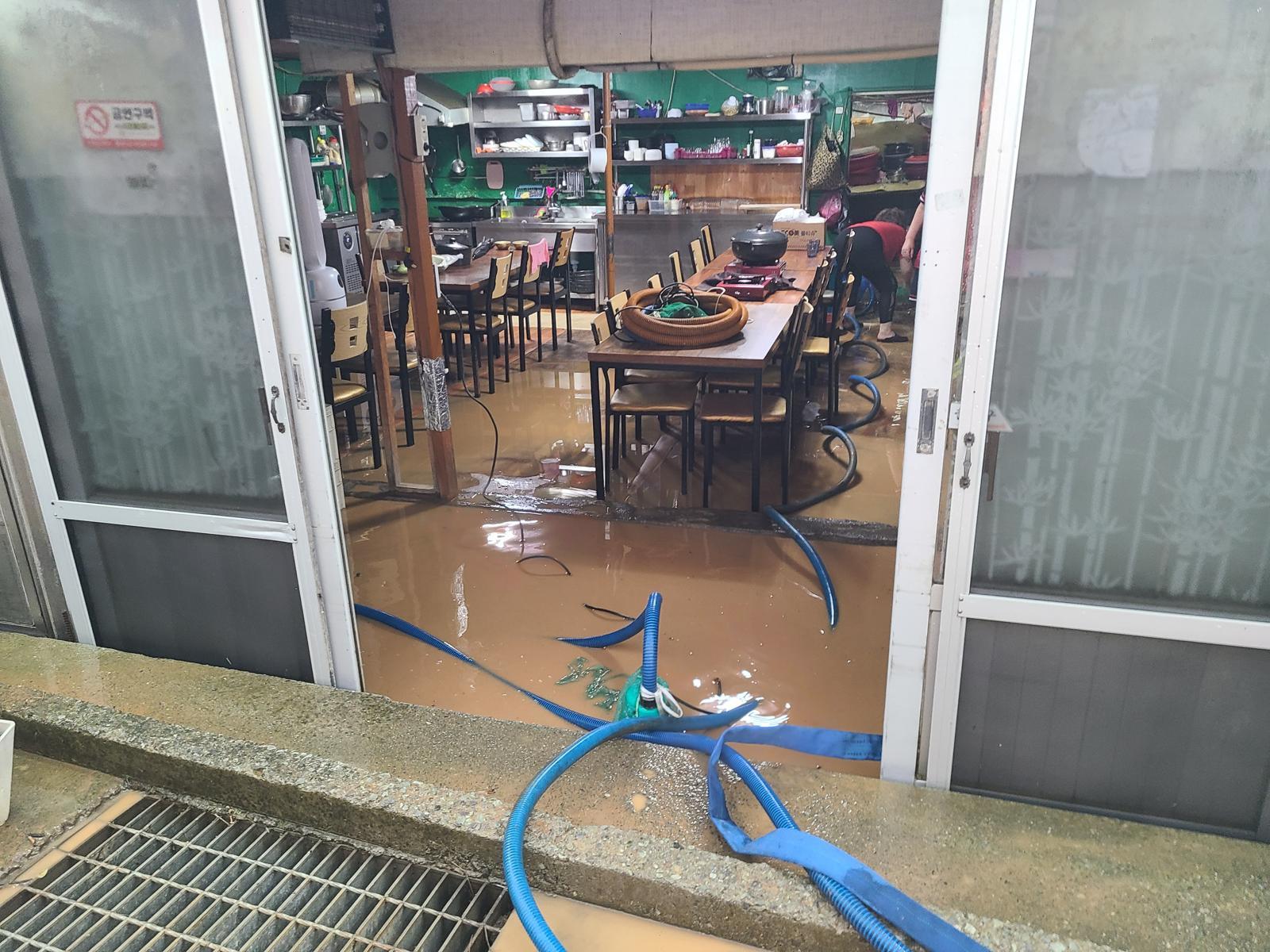
South Korea is bracing for continued heavy rainfall, with the Meteorological Administration forecasting intense downpours across most of the country on Monday. Areas in the southern coastal regions and Jeju Island have already experienced significant rainfall overnight, with Geojedo recording 782.5mm and Tongyeong 628.9mm.
Geojedo saw an extreme rate of 124.5mm of rain in just one hour, while Tongyeong experienced 96.7mm in the same period, causing widespread flooding that made walking difficult and submerged vehicles. The forecast indicates that these severe conditions will persist through Monday morning, with Busan and the southern coast of Gyeongnam expected to receive 50-100mm of rain per hour.
The agency has issued warnings for potential safety hazards, including landslides, floods, and dangerous currents. The heavy rain is attributed to a low-pressure system moving northeast from the Yellow Sea. While rain is expected nationwide on Monday, some areas in Gyeongnam and Jeju may see precipitation continue into the night.
In addition to the rain, some regions will experience high temperatures, with daytime highs reaching 27-32 degrees Celsius. The combination of warm surface temperatures and cooler air at higher altitudes is expected to create atmospheric instability, leading to localized downpours of 5-60mm in central and Jeolla regions from the afternoon into the evening.
DistantNews Editorial
Originally published by Hankyoreh in Korean. Translated, summarized, and contextualized by our editorial team with added local perspective. Read our editorial standards.
More Stories

From Our Blog

What Gets Lost (and Found) When News Is Translated

The Critical Role of Diaspora Media in Global News

What Travellers Should Know About Countries with Restricted Press

A Digital Nomad's Guide to Following Local News

How the Same Story Looks Different in Different Countries
