
Tropical Depression Two-E forms off Guerrero coast, forecasters predict torrential rains and tropical storm evolution
Translated from Spanish, summarized and contextualized by DistantNews.
At a glance
News
Sources not specified
Ongoing story
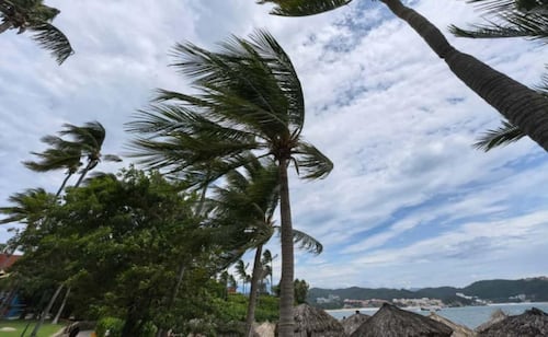
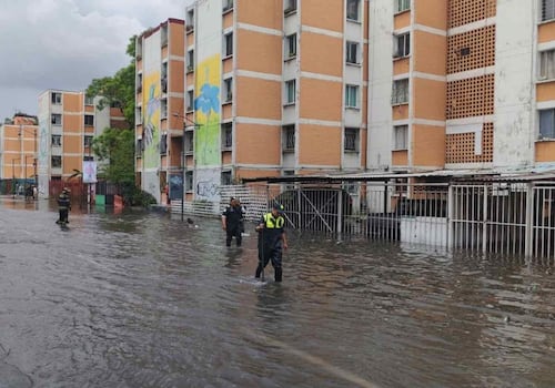
- Tropical Depression Two-E has formed off the coast of Guerrero, Mexico, with predictions of torrential rains.
- The depression is located 155 km south of Acapulco and is moving northwest at 9 km/h, with sustained winds of 55 km/h.
- It is expected to strengthen into a tropical storm and make landfall on Monday, prompting a storm watch for parts of Oaxaca and Guerrero.
Mexico's National Meteorological Service (SMN) announced the formation of Tropical Depression Two-E off the coast of Guerrero. The system is currently situated 155 km south of Acapulco and 165 km west-southwest of Punta Maldonado, moving northwest at approximately 9 km/h. It carries sustained winds of 55 km/h and gusts up to 75 km/h. Forecasters predict intense rainfall, with potential for torrential downpours of 150 to 250 mm, particularly in the western and coastal areas of Guerrero. Winds of 40 to 50 km/h, with gusts reaching 60 to 80 km/h, are also expected, intensifying by Sunday night. Coastal areas could experience wave heights of 2 to 3 meters. The SMN anticipates that Tropical Depression Two-E will evolve into a tropical storm within the coming hours and is projected to make landfall on Monday. A tropical storm watch has been issued for areas stretching from Lagunas de Chacahua, Oaxaca, to Técpan de Galeana, Guerrero. Additionally, heavy rains are forecast for Michoacán and Oaxaca, with strong rains expected in Jalisco, Colima, Guanajuato, State of Mexico, Mexico City, and Morelos. Authorities are urging the public in these affected states to exercise extreme caution due to the anticipated heavy rains, strong winds, and high waves.
DistantNews Editorial
Originally published by El Universal in Spanish. Translated, summarized, and contextualized by our editorial team with added local perspective. Read our editorial standards.
More Stories


From Our Blog

What Press Freedom Means for the News You Read

What Gets Lost (and Found) When News Is Translated

The Critical Role of Diaspora Media in Global News

What Travellers Should Know About Countries with Restricted Press

A Digital Nomad's Guide to Following Local News
