
Tropical Storm Arthur forms off Texas Gulf Coast
Summarized and contextualized by DistantNews.
At a glance
News
Official statement
Ongoing story
- Tropical Storm Arthur has formed off the Texas Gulf Coast, marking the first named storm of the Atlantic hurricane season.
- The storm is expected to bring heavy rain and flooding to a large area of the southeastern United States.
- Tropical storm warnings are in effect for parts of Texas and Louisiana, with potential for life-threatening flooding and strong winds.
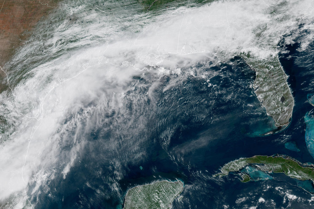
Tropical Storm Arthur officially formed off the Texas Gulf Coast on Wednesday, becoming the first named storm of the Atlantic hurricane season. The storm developed approximately 40 miles from Port O'Connor, Texas, with maximum sustained winds of 40 mph, just enough to meet the threshold for tropical storm status.
expected to cause life-threatening flooding
The National Hurricane Center forecasts minimal changes in strength as Arthur moves northeastward, potentially making landfall along the Texas coast or moving over coastal Texas. It is then expected to turn inland over southern Louisiana before weakening. Regardless of its exact path, the storm is projected to deliver significant rainfall and cause flooding across a broad swath of the southeastern United States, stretching from Houston to Atlanta.
Forecasters have issued warnings, anticipating "life-threatening flooding" and powerful winds in affected regions. Tropical storm warnings are in place from High Island, Texas, to Morgan City, Louisiana, indicating that tropical storm conditions are expected within 12 hours. A tropical storm watch is also active from Sargent, Texas, to High Island.
The deepest water will occur along the immediate coast near and to the east of the landfall location, where the surge will be accompanied by large and dangerous waves.
Arthur began developing earlier in the week as a tropical disturbance in the western Gulf of Mexico. Coastal communities in its path have already experienced intense rain and dangerous flash flooding. The storm is expected to dump between 5 to 10 inches of rain on parts of Texas, Louisiana, Mississippi, and Alabama, with potential for storm surge up to 4 feet above normal levels in coastal areas. "The deepest water will occur along the immediate coast near and to the east of the landfall location, where the surge will be accompanied by large and dangerous waves," the National Hurricane Center stated. "Life-threatening surf and rip current conditions" are also anticipated along the northwestern Gulf Coast.
life-threatening surf and rip current conditions
DistantNews Editorial
Originally published by CBS News. Summarized and contextualized by our editorial team with added local perspective. Read our editorial standards.
More Stories

From Our Blog

How the Same Story Looks Different in Different Countries

What Gets Lost (and Found) When News Is Translated

The Critical Role of Diaspora Media in Global News

What Travellers Should Know About Countries with Restricted Press

A Digital Nomad's Guide to Following Local News
