


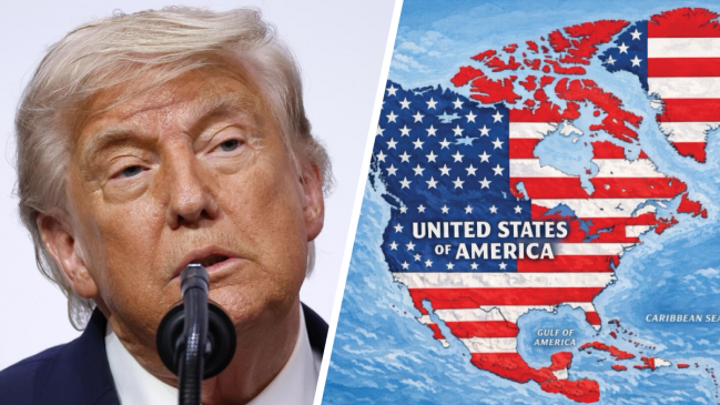
Trump renews confrontation with map showing Canada, Greenland and Mexico as part of the United States
Translated from Spanish and summarized by DistantNews. Read the original for the full story.
At a glance
News
Documents & data
Ongoing story
- Donald Trump posted a map depicting Mexico, the Caribbean, Canada, Greenland and Iceland under the colors of the U.S. flag.
- The image appeared on Trump’s Truth Social account as he again referred to Mexico, Canada and Greenland.
Donald Trump has revived his confrontational references to Mexico, Canada and Greenland by posting a map that places them under the U.S. flag.
The U.S. president shared the image on Monday on his Truth Social account. Red and white stripes representing the American flag cover Mexico, the Caribbean, Canada, Greenland and Iceland.
The post returned those territories to Trump’s public messaging without an accompanying explanation in the supplied report.
About this summary
Originally published by BioBioChile in Spanish. Translated, summarized, and contextualized automatically by DistantNews, with a note on how the source frames the story. Not individually reviewed before publishing. How this works.
More Stories


From Our Blog

News in Translation: What Gets Lost, and How We Keep the Framing

Diaspora Media: How Communities Follow News From Home

Traveling Where the Press Is Not Free: How to Read the News There

The Digital Nomad's Guide to Local News

The Same Story, Different Countries: How Coverage Changes at the Border
