Two easterly waves to increase rains and emergency risk in Guatemala
Translated from Spanish, summarized and contextualized by DistantNews.
At a glance
News
Named sources
Ongoing story
- Guatemala is expected to experience increased rainfall and potential emergencies due to two weather systems.
- The Institute of Seismology, Vulcanology, Meteorology, and Hydrology (Insivumeh) predicts increased instability and heavy downpours.
- Regions like San Marcos, Suchitepéquez, and Escuintla are most likely to see significant rainfall and potential landslides.
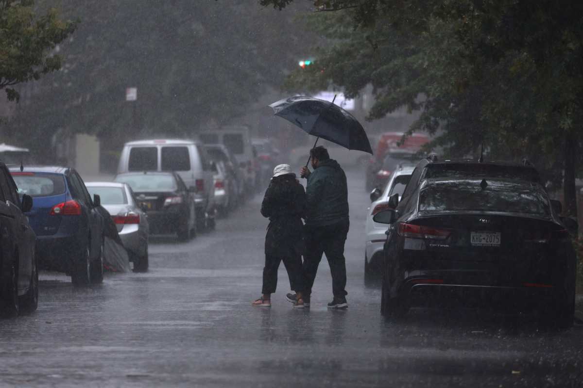
Guatemala is bracing for a week of intensified rainfall and a heightened risk of emergencies as two weather systems, known as "ondas del este" (easterly waves), are set to cross the country. The Institute of Seismology, Vulcanology, Meteorology, and Hydrology (Insivumeh) forecasts that these systems will bring increased atmospheric instability and substantial downpours.
Between June 22 and June 27, the tenth and eleventh easterly waves of the year are expected to impact Guatemala. Insivumeh director Edwin Rojas explained that these waves will carry abundant moisture, leading to increased cloud cover and precipitation across much of the nation. The forecast indicates that from June 22 to June 28, the country can anticipate afternoon and early evening thunderstorms, particularly in the southern and central regions.
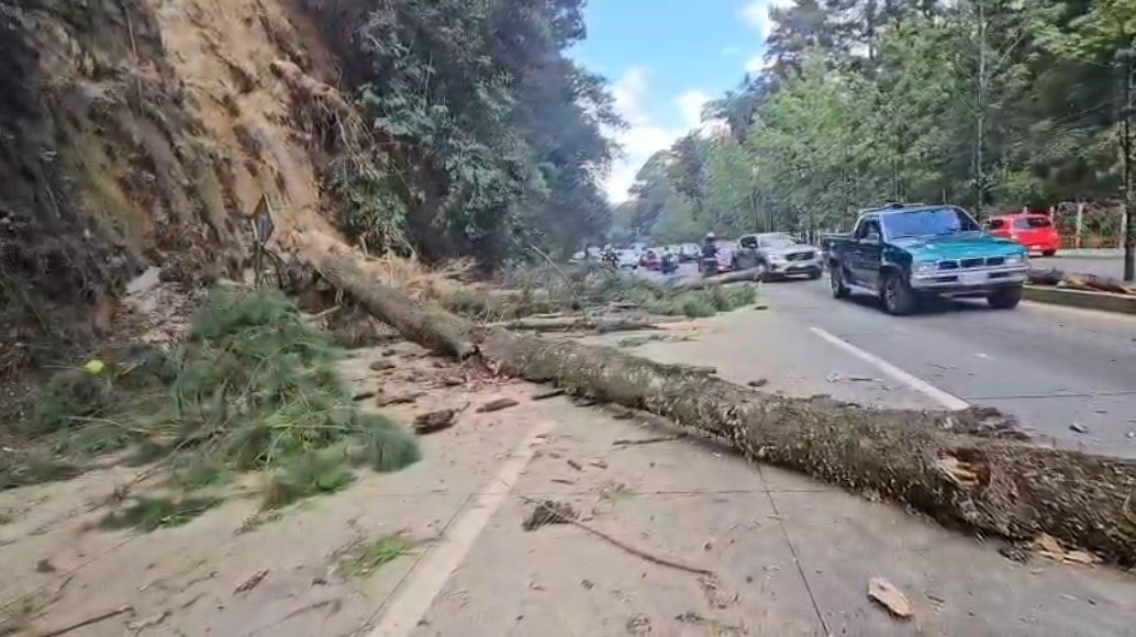
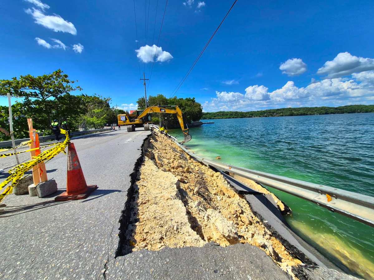
Insivumeh warns that conditions will be favorable for the development of severe local storms, characterized by significant rainfall over short periods, strong winds, and the potential for hail. The heaviest precipitation is anticipated in the departments of San Marcos, Suchitepéquez, and Escuintla, where rainfall totals could range between 25 and 200 millimeters throughout the week.
These increased rainfall levels raise concerns about flash floods, river overflows, landslides, and mudslides, especially in areas with steep slopes and along national roads. Insivumeh's impact-based forecasts, which combine rainfall data with terrain analysis, identify San Marcos and Quetzaltenango as departments with a higher probability of experiencing mass movements.
Authorities are urging the public to stay informed through official bulletins and to heed the guidance provided by emergency response teams and the National Coordinator for Disaster Reduction (Conred). The Insivumeh continues to monitor the situation closely to provide timely updates and warnings.
These systems will favor the entry of abundant moisture and conditions of atmospheric instability, which will increase cloudiness and precipitation in much of the national territory.
DistantNews Editorial
Originally published by Prensa Libre in Spanish. Translated, summarized, and contextualized by our editorial team with added local perspective. Read our editorial standards.
More Stories

From Our Blog

What Gets Lost (and Found) When News Is Translated

The Critical Role of Diaspora Media in Global News

What Travellers Should Know About Countries with Restricted Press

A Digital Nomad's Guide to Following Local News

How the Same Story Looks Different in Different Countries
