
Typhoon Rose moves northeast of Japan's Kyushu, prompting heavy rain and wind warnings
Translated from Korean, summarized and contextualized by DistantNews.
At a glance
News
Sources not specified
Ongoing story
- Typhoon Rose is moving northeast over the sea southeast of Kyushu, Japan, raising concerns about heavy rain and strong winds.
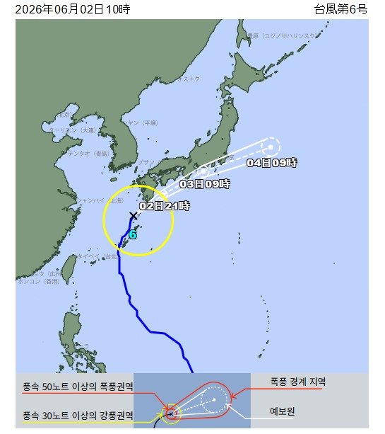
- The storm is expected to pass east of Japan by July 4, weakening into an extratropical cyclone.
- Authorities have issued warnings for heavy rainfall and potential disasters in several western and eastern Japanese prefectures.
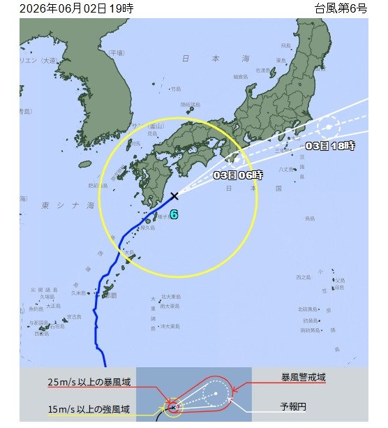
Typhoon Rose is tracking northeast over the sea southeast of Japan's Kyushu island, prompting concerns of heavy rain and strong winds along the western and eastern Pacific coasts. As of Thursday evening, the storm was located about 80 kilometers (50 miles) east-southeast of Miyazaki City, moving at 40 kilometers per hour (25 mph).
The Japan Meteorological Agency forecasts Rose to pass northeast of Shionomisaki in Wakayama Prefecture by Friday morning and east of Choshi City in Chiba Prefecture by Friday afternoon. It is expected to weaken into an extratropical cyclone over the waters east of Japan by Saturday.
The agency warned of potential heavy rainfall, especially in the Kyushu and Shikoku regions, with the possibility extending to the Kinki and Tokai regions. Specific prefectures like Wakayama, Mie, Aichi, and Shizuoka face a rapidly increasing risk of heavy rainfall disasters from Thursday night into Friday morning.
In Kagoshima Prefecture, over 30,000 households in the Amami region experienced power outages due to the typhoon's impact.
DistantNews Editorial
Originally published by Dong-A Ilbo in Korean. Translated, summarized, and contextualized by our editorial team with added local perspective. Read our editorial standards.
More Stories


From Our Blog

What Gets Lost (and Found) When News Is Translated

The Critical Role of Diaspora Media in Global News

What Travellers Should Know About Countries with Restricted Press

A Digital Nomad's Guide to Following Local News

How the Same Story Looks Different in Different Countries
