Vigilance activated for three days due to presence of tropical wave No. 14
Translated from Spanish, summarized and contextualized by DistantNews.
At a glance
News
Sources not specified
Ongoing story
- Panama's Institute of Meteorology and Hydrology (Imhpa) has issued a vigilance notice for tropical wave No. 14.
- The tropical wave is expected to bring heavy rains, strong winds, and electrical activity across the country.
- The alert is in effect until June 23, with particular concern for the Darién and Chiriquí provinces.
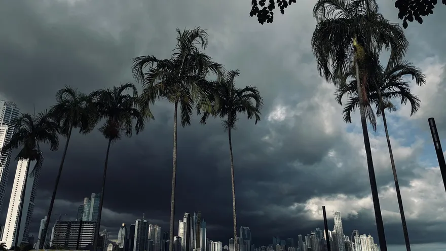
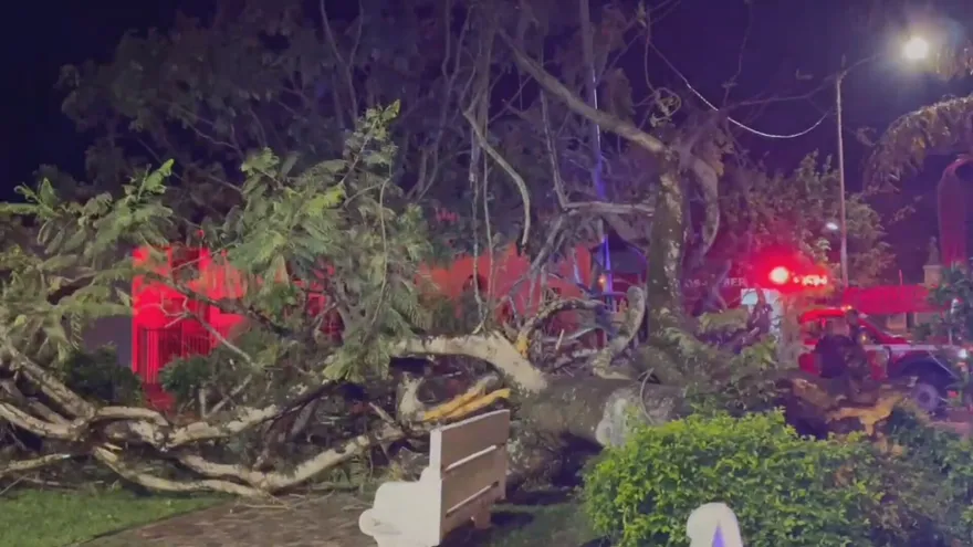
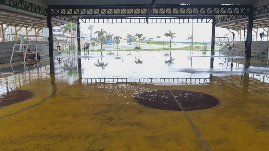
Panama's Institute of Meteorology and Hydrology (Imhpa) has issued a new vigilance notice due to the entry of tropical wave number 14 into the national territory. Technical reports indicate that this phenomenon has interacted with the local geography after two previous waves dissipated before reaching land. Currently, climatic conditions show significant instability in the eastern and central regions of the country, generating considerable storms that are rapidly moving westward. Heavy rainfall is expected to continue in the coming hours. Imhpa authorities detailed that precipitation and downpours will intensify due to daytime heating, directly affecting a large part of the Panamanian isthmus, with a particular impact on the Pacific coast. The vigilance notice will remain in effect until June 23, warning of potentially heavy rains accompanied by wind gusts and electrical activity in various sectors. Although meteorological projections suggest the tropical wave may gradually dissipate, its remnants are expected to maintain unstable weather nationwide. The largest accumulations of water are estimated in the provinces of Darién and Chiriquí.
DistantNews Editorial
Originally published by TVN Panamá in Spanish. Translated, summarized, and contextualized by our editorial team with added local perspective. Read our editorial standards.
More Stories

From Our Blog

What Gets Lost (and Found) When News Is Translated

The Critical Role of Diaspora Media in Global News

What Travellers Should Know About Countries with Restricted Press

A Digital Nomad's Guide to Following Local News

How the Same Story Looks Different in Different Countries
