


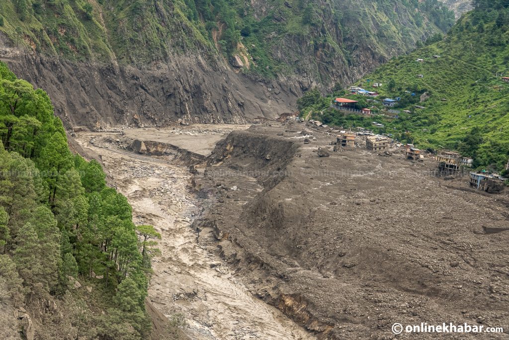
What caused the Rasuwa flood? Experts point to possible glacial lake outburst
Summarized and contextualized by DistantNews.
At a glance
News
Named sources
Ongoing story
- A powerful flood in Nepal's Rasuwa district on Wednesday is suspected to be caused by a glacial lake outburst or a landslide in China.
- The flood hit Timure, causing significant loss of life and destroying property along the Bhote Koshi and Trishuli rivers.
- Experts are divided on the exact cause, with theories including the bursting of a glacial lake or a landslide dam failure, requiring further scientific investigation.
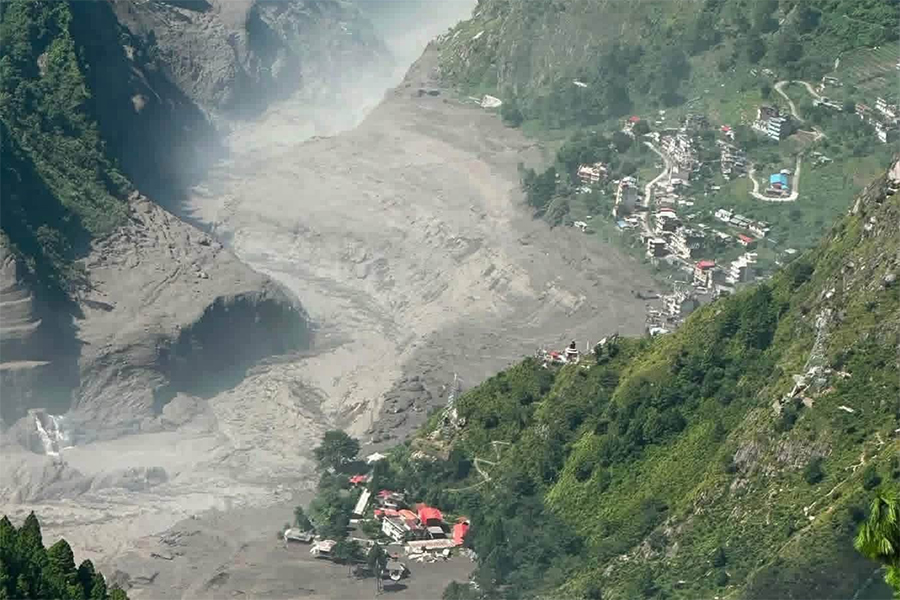
A devastating flood that swept through Nepal's Rasuwa district on Wednesday morning is believed to have originated from a potential glacial lake outburst or a landslide in the neighboring Tibetan region of China. The exact cause remains unconfirmed by scientific analysis, but the impact on the Timure area, situated along the Bhote Koshi and Trishuli rivers, was severe, resulting in loss of life and destruction of settlements and infrastructure.
Experts suggest the flood's source could be approximately 40–50 kilometers upstream from the Nepal-China border, an area known to host several potentially hazardous glacial lakes. One prevailing theory posits that one or more of these lakes may have suddenly released a massive volume of water. An alternative hypothesis points to a landslide or avalanche that created a temporary natural dam, which later collapsed, triggering the flood.
We cannot say at this stage which lake failed or how.
Ranjan Kumar Dahal, a professor at Tribhuvan University's Central Department of Geology, indicated that such a large-scale flood would likely involve a significant avalanche and a subsequent glacial lake outburst. He noted that three nearby glacial lakes in the upper Lhende River area might have been involved, though the specific lake or mechanism of failure is unclear. Researcher Amrit Thapa from the University of Alaska Fairbanks also leans towards an avalanche as the trigger, based on initial discussions with scientists from both Nepal and China.
The National Disaster Risk Reduction and Management Authority (NDRRMA) cited satellite imagery suggesting a snow-and-rock landslide occurred about 20 kilometers northeast of the Rasuwagadhi border point. This landslide reportedly caused a debris-laden flood in the Lhende River, which then flowed into the Trishuli River. However, a consensus among experts on whether the event should be classified as a Glacial Lake Outburst Flood (GLOF) is still lacking, with some favoring the glacial lake theory and others the avalanche-induced dam collapse. Further scientific investigation is deemed essential for a definitive conclusion.
The assessment was based on preliminary discussions with scientists from Nepal and China.
DistantNews Editorial
Originally published by OnlineKhabar English. Summarized and contextualized by our editorial team with added local perspective. Read our editorial standards.
More Stories


From Our Blog

What Gets Lost (and Found) When News Is Translated

The Critical Role of Diaspora Media in Global News

What Travellers Should Know About Countries with Restricted Press

A Digital Nomad's Guide to Following Local News

How the Same Story Looks Different in Different Countries
