


Archaeologists map ancient Pella's boundaries and harbor using non-invasive surveys
Translated from Greek, summarized and contextualized by DistantNews.
At a glance
News
Named sources
Context piece
- Archaeologists are using geophysical surveys to map the ancient city of Pella in Greece without extensive excavation.
- The research, a collaboration between Greek authorities and the University of Michigan, aims to reconstruct the city's history and boundaries.
- Surveys have identified the city's southern limits and the location of its ancient harbor, revealing insights into its early development and maritime connections.
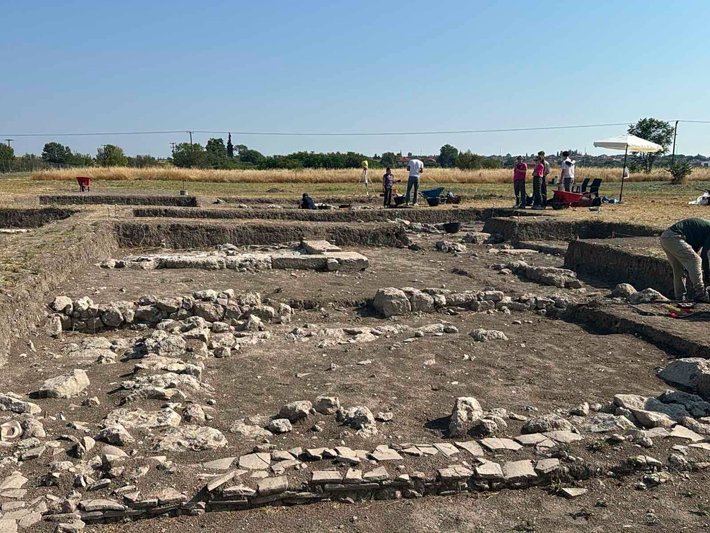
Archaeologists are employing advanced non-invasive techniques to uncover the secrets of the ancient Macedonian capital, Pella. Through the Pella Urban Dynamics Project, a joint initiative by the Ephorate of Antiquities of Pella and the University of Michigan, researchers are gaining unprecedented insights into the city's layout and history.
The Hellenistic period of Pella is well-documented through excavations. What interests us now is the early history of Pella.
The project, now in its second five-year phase, focuses on reconstructing Pella's past, precisely defining its boundaries, and understanding the evolution of daily life within the Hellenistic kingdom's capital. The research is directed by Dr. Elisavet Tsigarida, honorary Director of the Hellenic Ministry of Culture and Sports; Dr. Stratos Nanoglou, archaeologist at the Ephorate of Antiquities of Thessaloniki; Professor Lisa Nevett of the University of Michigan; and archaeologist Dr. David Stone. Their work combines geophysical surveys, surface exploration, and targeted excavations.
Geophysical surveys are proving instrumental, allowing archaeologists to "see" beneath the ground without the need for extensive digging. These surveys have been crucial in identifying the city's southern boundaries and pinpointing the ancient coastline, which was much closer to Pella in antiquity. "With geophysical survey, we were able to identify buildings that likely relate to the ancient harbor facilities," stated Dr. Tsigarida to the Athens-Macedonian News Agency.
The data we have indicates that by the early 4th century BC, the building fabric we recognize in the Hellenistic city today had already taken shape. When the Macedonians founded the new city to the south, near the sea, it developed with this urban planning.
"The most striking finding was that where the survey indicated buildings ended, surface survey findings also ceased. Beyond that point, there were no traces of human activity, confirming that the sea was located at that spot," she added. While the Hellenistic period of Pella is well-documented through excavations, the project is particularly interested in the city's earlier history. Evidence suggests Pella existed before the founding of the Macedonian city, though its earlier form remains largely unknown. The ongoing research also delves into the daily lives of Pella's inhabitants, including excavations of a dwelling that utilize modern sampling and soil analysis methods to detect traces of food and organic materials.
With geophysical survey, we were able to identify buildings that likely relate to the ancient harbor facilities. The most striking finding was that where the survey indicated buildings ended, surface survey findings also ceased. Beyond that point, there were no traces of human activity, confirming that the sea was located at that spot.
DistantNews Editorial
Originally published by Ta Nea in Greek. Translated, summarized, and contextualized by our editorial team with added local perspective. Read our editorial standards.
More Stories



From Our Blog

What Gets Lost (and Found) When News Is Translated

The Critical Role of Diaspora Media in Global News

What Travellers Should Know About Countries with Restricted Press

A Digital Nomad's Guide to Following Local News

How the Same Story Looks Different in Different Countries
