


Bhotekoshi Flood: A 10-Hour Timeline from Tibet Surge to Devghat
Translated from English and summarized by DistantNews. Read the original for the full story.
At a glance
News
Documents & data
Outcome reported
- A technical report details the 10-hour progression of the Bhotekoshi flood, originating from a surge in Tibet.
- Authorities received initial information at 9:05 am, issuing early warnings via SMS to affected districts.
- Monitoring stations recorded critical water levels, with the flood impacting areas from Rasuwa to Devghat.
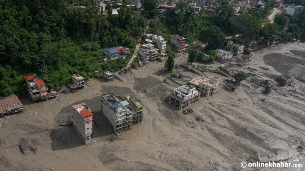
A devastating flood surge originating in Tibet rapidly moved downstream through Nepal's Bhotekoshi and Trishuli rivers over a 10-hour period, according to a technical assessment by the Flood Forecasting Division. Authorities received initial information at 9:05 am on Wednesday that a major flood had entered the Bhotekoshi from the Tibetan side, initiating a cascade of events that would impact multiple districts.
The report details a critical sequence of events. A magnitude 4.4 earthquake was recorded at 8:37 am, shortly before the water-level monitoring station in Syabrubesi, Rasuwa, ceased transmitting data at 8:50 am. Its last reading showed the river at a relatively low 1.62 meters, far below the warning level of 6 meters. Just minutes later, at 9:05 am, the flood's entry from Tibet was confirmed.
Authorities responded by issuing early warnings. Between 9:15 am and 9:16 am, over 600,000 SMS alerts were sent to residents in high-risk areas of Rasuwa, Nuwakot, Dhading, and Chitwan. The Betrawati water-level monitoring station also stopped transmitting data at 9:20 am, having last recorded a level of 3.55 meters. By 10:28 am, the flood was projected to reach the Dhading-Galchhi area, prompting further warnings along the Prithvi Highway and the Muglin-Narayanghat road.
The flood's destructive path continued, with the Phurke river bridge and other structures swept away by 11:43 am. By 1 pm, confirmation arrived that the flood had passed Muglin, and warnings were issued to communities along the river as far as Devghat. The river level at Devghat reached 4.76 meters by 1:30 pm, with initial estimates predicting a peak of around 8 meters. The Kalikhola monitoring station later recorded a peak level of 12.3 meters before the water level at Devghat peaked at 6.57 meters at 4 pm, eventually receding by 6:30 pm.
About this summary
Originally published by Kathmandu Post in English. Translated, summarized, and contextualized automatically by DistantNews, with a note on how the source frames the story. Not individually reviewed before publishing. How this works.
More Stories


From Our Blog

What Gets Lost (and Found) When News Is Translated

The Critical Role of Diaspora Media in Global News

What Travellers Should Know About Countries with Restricted Press

A Digital Nomad's Guide to Following Local News

How the Same Story Looks Different in Different Countries
