

Category 5 Super Typhoon Bavi makes landfall on Pacific islands
Translated from Spanish, summarized and contextualized by DistantNews.
At a glance
News
From a news agency
Ongoing story
- Super Typhoon Bavi, a Category 5 storm, made landfall on the Mariana Islands with extreme intensity.
- The storm brought torrential rains, high surf, destructive winds, and the threat of flash floods and landslides.
- Bavi is now moving west but continues to pose a threat with its outer bands, and is expected to weaken gradually as it approaches Taiwan and mainland China.
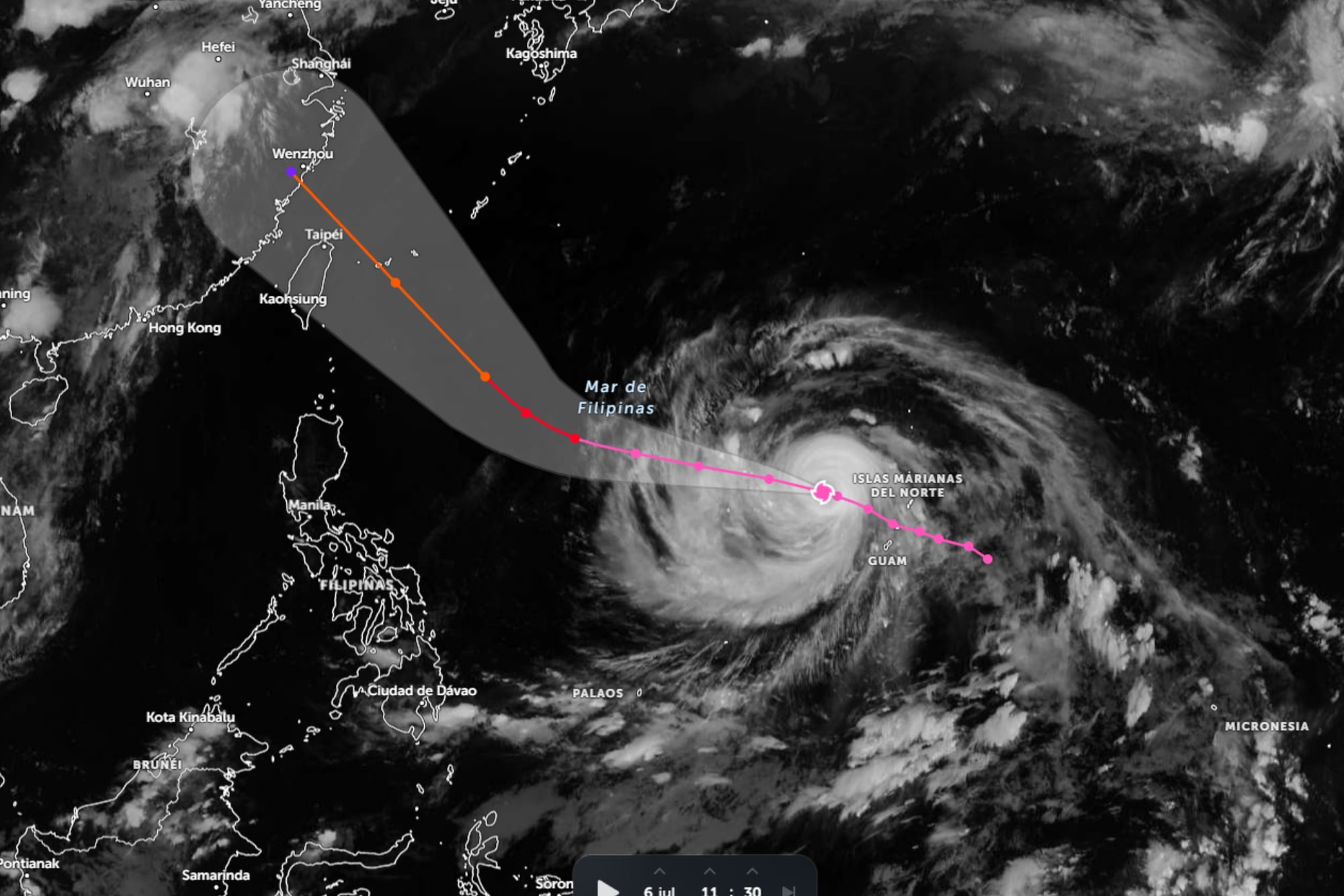
Super Typhoon Bavi, a powerful Category 5 storm, has made landfall on the Mariana Islands, bringing extreme conditions and posing a significant risk to the population. The cyclone, packing sustained winds of up to 175 mph (282 km/h) and gusts exceeding 200 mph (322 km/h), made a direct hit on the island of Rota.
Despite the storm's center moving west of the archipelago, the danger persists. Outer bands of Bavi are still unleashing intense rainfall, strong winds, and storm surges, leading to hazardous coastal conditions and a continued threat of flash floods and landslides. Waves of 25 to 30 feet (7.6 to 9.1 meters) are expected to persist around the Mariana Islands.
Authorities are awaiting improved weather conditions to fully assess the damage, with widespread power outages and significant infrastructure damage anticipated. The typhoon's strength was fueled by exceptionally warm ocean waters, allowing it to maintain its intensity. While Bavi is expected to weaken gradually over the ocean, it will remain a powerful system as it approaches Taiwan and mainland China.
DistantNews Editorial
Originally published by La Nación in Spanish. Translated, summarized, and contextualized by our editorial team with added local perspective. Read our editorial standards.
More Stories



From Our Blog

What Gets Lost (and Found) When News Is Translated

The Critical Role of Diaspora Media in Global News

What Travellers Should Know About Countries with Restricted Press

A Digital Nomad's Guide to Following Local News

How the Same Story Looks Different in Different Countries
