

Environment authority surveys Masirah's coastal ecosystems
Translated from English, summarized and contextualized by DistantNews.
At a glance
News
Named sources
New plan
- The Environment Authority has begun field surveys of coastal ecosystems in Masirah to assess their environmental condition.
- The surveys aim to evaluate coastal health, enhance biodiversity data, and identify areas needing protection.
- Advanced technologies, including drones, are used to document beach and lagoon characteristics and monitor changes.
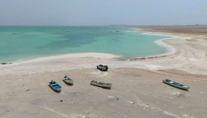
The Environment Authority has launched extensive field surveys on the coast of Masirah, an island in Oman's South A’Sharqiyah Governorate. These surveys are part of the authority's operational targets for 2026, focusing on two key indicators: the frequency of coastal marine ecosystem surveys and the connectivity of water between lagoons and the sea.
The initiative seeks to thoroughly evaluate the environmental status of coastlines and coastal wetlands. It also aims to enrich the national biodiversity database with accurate, up-to-date information. The data gathered will help assess the condition of beaches, understand their natural components, and identify any environmental pressures they face. This information is crucial for pinpointing environmentally significant areas that require protection and targeted management.
Fieldwork involves detailed beach surveys, dividing coastlines into four-kilometer segments to document their nature and composition. Researchers are also monitoring coastal erosion, noting observations of mangroves, coastal plants, sea turtle nesting sites, invertebrates, and birds. Waste types found on beaches are being inventoried to understand pollution levels.
Furthermore, the surveys examine coastal wetlands, specifically measuring water connectivity between lagoons and the sea. This involves assessing physical water indicators during high tide and conducting hydrological measurements of lagoons, including opening width and depth, tidal influence, and water penetration. Biodiversity within these wetland areas is also being documented.
Ghasi Hamad Al Farsi, Supervisor of the Environmental Control Unit at the Environment Authority Center in Masirah, highlighted the scientific importance of these surveys. He stated they provide essential data for assessing coastal ecosystems and guiding environmental management efforts based on concrete results. The team is employing advanced sensing and aerial documentation technologies, including drones, to capture aerial views of the sites. These drone-based observations help monitor lagoon sizes, openings, mangrove spread, and erosion lines, providing a visual reference for future comparisons and tracking environmental changes over time.
these surveys represent one of the important scientific foundations for assessing the environmental condition of coastal ecosystems and providing field information that contributes to identifying areas eligible for protection and guiding environmental management work based on actual data and results.
DistantNews Editorial
Originally published by Times of Oman in English. Translated, summarized, and contextualized by our editorial team with added local perspective. Read our editorial standards.
More Stories
From Our Blog

What Gets Lost (and Found) When News Is Translated

The Critical Role of Diaspora Media in Global News

What Travellers Should Know About Countries with Restricted Press

A Digital Nomad's Guide to Following Local News

How the Same Story Looks Different in Different Countries
