


Lake Burst Risk Near China-Nepal Border Disaster Site Decreases
Translated from English and summarized by DistantNews. Read the original for the full story.
At a glance
News
From a news agency
Ongoing story
- The risk of a glacial lake bursting near the China-Nepal border has decreased, according to Chinese authorities.
- Satellite imagery indicates the lake's size has shrunk, with water slowly flowing through, reducing the reservoir.
- A glacier collapse earlier in the week caused a devastating flood, sweeping away a border complex and leaving hundreds dead or missing.
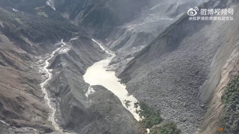
Chinese authorities have reported a decrease in the threat posed by a glacial lake that formed near the China-Nepal border following a recent glacier collapse. The lake, which had raised concerns about potential secondary disasters, appears to be slowly draining.
Water in the lake has been slowly flowing through, decreasing the reservoir gradually.
Satellite images captured between Thursday and Saturday morning show that the water in the lake, situated at the confluence of two rivers straddling the border, has been gradually flowing through. This natural outflow has led to a reduction in the reservoir's size. By early Saturday morning, the lake's surface area on the Purepu Tsangpo river was measured at 99,000 square meters, a decrease of 21,000 square meters compared to Thursday's images. This is roughly equivalent to the size of 14 football fields.
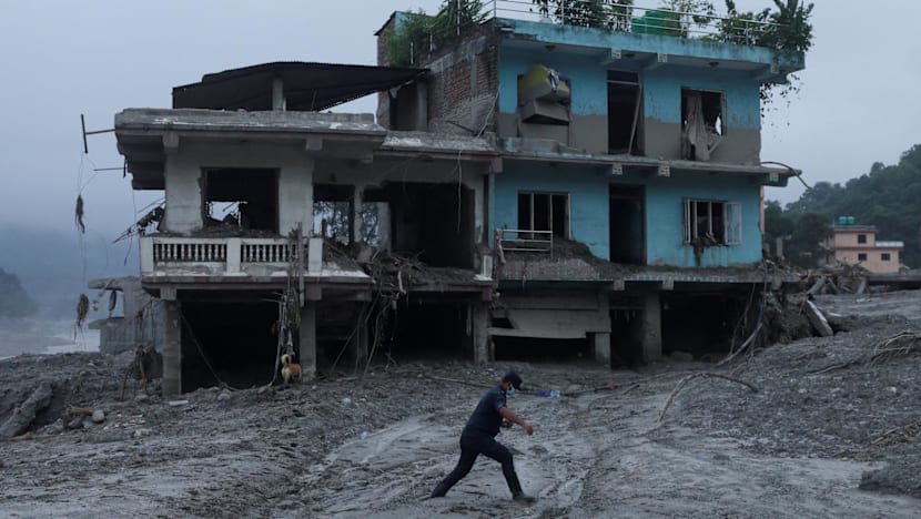
The formation of this lake was a consequence of a powerful glacier collapse on Wednesday. The collapse unleashed a torrent of rock, ice, mud, and debris down Himalayan mountain river systems. This devastating flood swept away a border port complex connecting China's Tibet Autonomous Region with Nepal. The disaster has resulted in hundreds of deaths and thousands of people missing.
The ministry said satellite imagery of the surface area of the lake at Purepu Tsangpo river showed it was 99,000 sqm in size on early Saturday morning - around the size of 14 football fields combined - having shrunk by 21,000 sqm compared with images from Thursday.
Experts and authorities had warned of a high risk of secondary disasters in the valley, particularly from the debris-formed lake, which posed a danger to rescue operations downstream. China Anneng, a state-owned enterprise, dispatched a reconnaissance team with drones and surveillance equipment to monitor the lake. An overflow from the lake on Friday had temporarily halted rescue work, but subsequent assessments deemed the risks manageable.
We estimate its area to be over 120,000 square meters, but its depth is currently unknown.
Officials also noted another, larger body of water at the base of the glacier collapse, estimated to be over 120,000 square meters, though its depth remains unknown. Flood risks will persist until both lakes have fully drained, according to Nepal's Disaster Management Authority. Meanwhile, rescue efforts continue amidst challenging weather conditions, with teams combing through the debris for survivors.
Flood risks will remain until the two lakes have fully drained.
About this summary
Originally published by CNA in English. Translated, summarized, and contextualized automatically by DistantNews, with a note on how the source frames the story. Not individually reviewed before publishing. How this works.
More Stories


From Our Blog

What Gets Lost (and Found) When News Is Translated

The Critical Role of Diaspora Media in Global News

What Travellers Should Know About Countries with Restricted Press

A Digital Nomad's Guide to Following Local News

How the Same Story Looks Different in Different Countries
