


Magnitude 6.4 Earthquake Shakes North Sumatra, Felt in Aceh
Translated from Indonesian, summarized and contextualized by DistantNews.
At a glance
News
Official statement
Context piece
- A magnitude 6.4 earthquake struck Simalungun Regency, North Sumatra, on Saturday afternoon at 5:57 PM WIB.
- The earthquake occurred at a depth of 163 kilometers and was felt in parts of Aceh province.
- The Meteorology, Climatology, and Geophysics Agency (BMKG) reported the earthquake did not have the potential to cause a tsunami, and there is currently no information on casualties or damage.
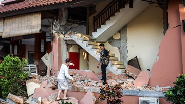
A powerful magnitude 6.4 earthquake jolted Simalungun Regency in North Sumatra on Saturday afternoon, August 15, 2026, at approximately 5:57 PM Western Indonesian Time. The tremor originated at a depth of 163 kilometers, with its epicenter located about 10 kilometers southeast of Simalungun.
The earthquake's impact was felt across a wide area, including parts of Aceh province. Residents in Meulaboh, West Aceh Regency, described experiencing panic, with Sovi, a resident of Suak Ribee Village, stating that she and her children evacuated their home due to the shaking. "We were quite panicked during the earthquake earlier, my children and I ran out of the house because we were afraid of the earthquake's sway," she said.
The Meteorology, Climatology, and Geophysics Agency (BMKG) confirmed the earthquake's parameters, noting its significant magnitude and depth. Crucially, BMKG stated that the earthquake did not pose a tsunami risk. As of the latest reports, there have been no official updates regarding any casualties or damage resulting from the seismic event.
DistantNews Editorial
Originally published by Republika in Indonesian. Translated, summarized, and contextualized by our editorial team with added local perspective. Read our editorial standards.
More Stories


From Our Blog

What Gets Lost (and Found) When News Is Translated

The Critical Role of Diaspora Media in Global News

What Travellers Should Know About Countries with Restricted Press

A Digital Nomad's Guide to Following Local News

How the Same Story Looks Different in Different Countries
