

Magnitude 7.7 earthquake off Indonesian coast triggers tsunami warning
Translated from Korean, summarized and contextualized by DistantNews.
At a glance
News
From a news agency
Ongoing story
- A magnitude 7.7 earthquake struck off the coast of Indonesia's Flores Island, prompting a tsunami warning.
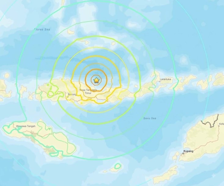
- The epicenter was about 68 km northwest of the island's northern coast at a depth of 10 km.
- Authorities are assessing the impact, and no casualties or damage have been reported yet.
A powerful magnitude 7.7 earthquake jolted the waters off Indonesia's Flores Island on August 15, prompting authorities to issue a tsunami warning. The United States Geological Survey (USGS) reported the quake, with its epicenter located approximately 68 kilometers northwest of the island's northern coast at a shallow depth of 10 kilometers.
The European-Mediterranean Seismological Centre (EMSC) initially recorded the tremor at magnitude 6.9, later revising it to 7.6. Such a powerful earthquake, if occurring in a populated urban center, could paralyze city functions, as evidenced by the 1999 Taiwan earthquake of similar magnitude which caused over 2,400 deaths and damaged 100,000 buildings.
Indonesia's Meteorology, Climatology, and Geophysics Agency (BMKG) issued the tsunami alert due to the shallow depth of the earthquake, indicating a high potential for tsunami waves. While Indonesian authorities are still assessing the situation, no immediate reports of casualties or property damage have been confirmed. Indonesia lies on the Pacific's "Ring of Fire," a geologically active zone known for frequent earthquakes and volcanic eruptions, which has historically led to significant disasters in the region.
DistantNews Editorial
Originally published by Dong-A Ilbo in Korean. Translated, summarized, and contextualized by our editorial team with added local perspective. Read our editorial standards.
More Stories


From Our Blog

What Gets Lost (and Found) When News Is Translated

The Critical Role of Diaspora Media in Global News

What Travellers Should Know About Countries with Restricted Press

A Digital Nomad's Guide to Following Local News

How the Same Story Looks Different in Different Countries
