

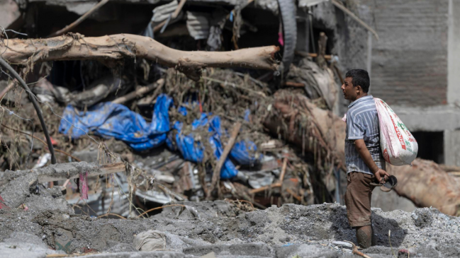

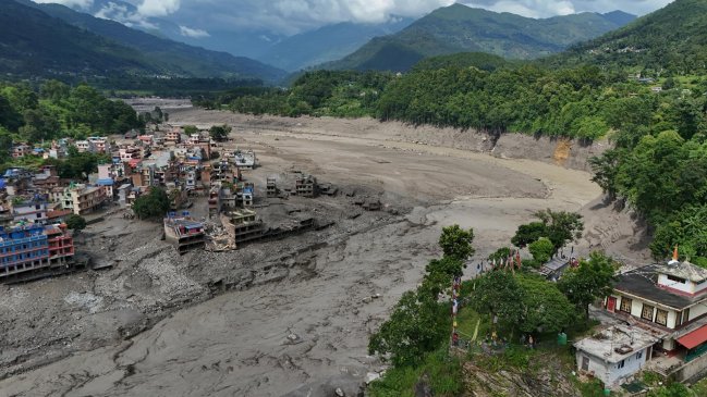
Satellite images reveal scale of deadly flash flood tragedy in Nepal
Translated from Spanish and summarized by DistantNews. Read the original for the full story.
At a glance
News
Documents & data
Outcome reported
- Satellite images reveal the extensive damage caused by a violent flash flood in northern Nepal.
- The disaster occurred on Wednesday, sweeping through multiple villages.
- Images from Planet Labs and the Copernicus satellite system show the before-and-after impact of the massive landslide and flood.
Satellite imagery has provided a stark visual representation of the devastation wrought by a violent flash flood in northern Nepal. The images, released by Planet Labs and the Copernicus satellite system, clearly illustrate the scale of the disaster that struck on Wednesday, impacting numerous villages.
The before-and-after comparisons offered by the satellite views highlight the destructive power of the massive landslide and subsequent floodwaters. They show the dramatic transformation of the landscape, underscoring the immense force that reshaped the affected areas and the extent of the destruction to homes and infrastructure.
This natural disaster has caused significant loss and displacement in the region. The detailed satellite data is crucial for assessing the full scope of the damage, aiding in rescue and recovery efforts, and planning for future mitigation strategies. The images serve as a somber testament to the tragedy that has befallen the communities in northern Nepal.
About this summary
Originally published by BioBioChile in Spanish. Translated, summarized, and contextualized automatically by DistantNews, with a note on how the source frames the story. Not individually reviewed before publishing. How this works.
More Stories


From Our Blog

What Gets Lost (and Found) When News Is Translated

The Critical Role of Diaspora Media in Global News

What Travellers Should Know About Countries with Restricted Press

A Digital Nomad's Guide to Following Local News

How the Same Story Looks Different in Different Countries
