

Tropical Storm Bertha spreads across northwestern Florida
Summarized and contextualized by DistantNews.
At a glance
News
From a news agency
Ongoing story
- Tropical Storm Bertha is moving across northwestern Florida, bringing coastal flooding and heavy rainfall.
- The storm has maximum sustained winds of 60 mph and is expected to weaken by Wednesday.
- Forecasters predict a below-normal Atlantic hurricane season due to El Niño conditions.
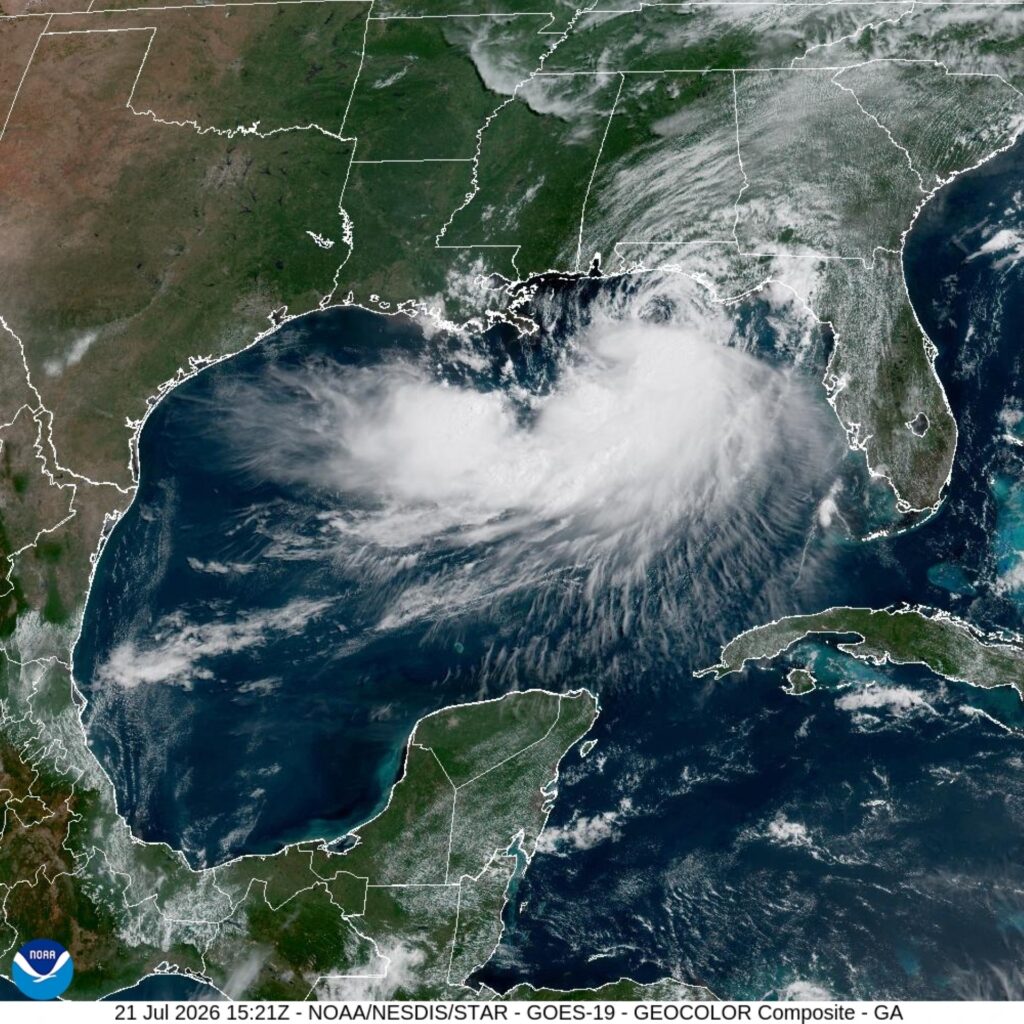
Tropical Storm Bertha is spreading across northwestern Florida, prompting concerns of coastal flooding and heavy rainfall, according to the National Hurricane Center.
The storm, the second named storm of the Atlantic season, was located about 90 miles southwest of Panama City, Florida. It carries maximum sustained winds of 60 mph and is currently moving westward. Forecasters anticipate Bertha will begin to weaken by Wednesday.
Tropical storm warnings and watches are in effect for parts of Florida and Louisiana. The National Hurricane Center advised that "Tropical storm conditions will continue spreading across portions of the warning area later today through Wednesday." A combination of storm surge and tides is expected to cause flooding in areas near the immediate coast.
Bertha is projected to produce 2 to 4 inches of rainfall across western Florida and southern Louisiana through Thursday, with isolated totals potentially reaching 6 inches. This rainfall could lead to flash flooding, particularly in urban areas. Despite the current storm activity, officials are forecasting a below-normal Atlantic hurricane season, which runs until November 30, due to the return of El Niño conditions that typically suppress storm development in the Atlantic basin.
Tropical storm conditions will continue spreading across portions of the warning area later today through Wednesday.
DistantNews Editorial
Originally published by Jamaica Observer. Summarized and contextualized by our editorial team with added local perspective. Read our editorial standards.
More Stories

From Our Blog

What Gets Lost (and Found) When News Is Translated

The Critical Role of Diaspora Media in Global News

What Travellers Should Know About Countries with Restricted Press

A Digital Nomad's Guide to Following Local News

How the Same Story Looks Different in Different Countries
