


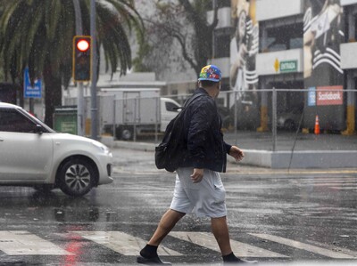
Tropical wave to bring heavy rains and intense heat to Dominican Republic
Translated from Spanish, summarized and contextualized by DistantNews.
At a glance
News
Sources not specified
Context piece
- A tropical wave combined with a trough will bring heavy rains, thunderstorms, and gusty winds across much of the Dominican Republic on Saturday.
- Isolated showers are expected in the morning, with moderate to heavy downpours and thunderstorms likely in the afternoon, particularly in eastern and southern provinces.
- The National Meteorology Office (Indomet) has issued weather alerts for the Greater Santo Domingo and San Cristóbal areas due to the risk of urban flooding.
The Dominican Republic is bracing for significant rainfall and thunderstorms on Saturday as a tropical wave interacts with a trough over the Mona Passage. The National Meteorology Office (Indomet) forecasts widespread downpours, electrical storms, and gusty winds across much of the country.
While isolated showers may occur in the morning, particularly along the southern coast, the weather is expected to intensify in the afternoon. Indomet predicts moderate to heavy rainfall, accompanied by thunderstorms and strong gusts, affecting numerous provinces including La Altagracia, La Romana, San Pedro de Macorís, El Seibo, Hato Mayor, Monte Plata, Sánchez Ramírez, La Vega, Monseñor Nouel, Azua, San Juan, Santiago, Valverde, Santiago Rodríguez, Elías Piña, Dajabón, Monte Cristi, Independencia, Bahoruco, and the Greater Santo Domingo area.
Due to the anticipated heavy precipitation, Indomet's National Forecast Center has placed the Greater Santo Domingo and San Cristóbal regions under weather alerts. Residents in these areas face a heightened risk of urban flooding within the next 24 hours. The intense heat is also expected to persist, with high humidity contributing to a very elevated heat index. Indomet advises the public to stay hydrated, wear light-colored clothing, avoid direct sun exposure between 11 a.m. and 5 p.m., and seek cool, well-ventilated areas.
Looking ahead to Sunday, the tropical wave is forecast to move away, but lingering moisture and the trough will still contribute to increased cloudiness in the afternoon. Scattered showers and thunderstorms are expected in the northeastern, southwestern, Cibao Valley, and Central Mountain Range regions. Maritime conditions near the southern and southwestern coasts of Pedernales require caution for small vessels due to abnormal winds and waves, though other coastal areas remain unaffected.
DistantNews Editorial
Originally published by Diario Libre in Spanish. Translated, summarized, and contextualized by our editorial team with added local perspective. Read our editorial standards.
More Stories



From Our Blog

What Gets Lost (and Found) When News Is Translated

The Critical Role of Diaspora Media in Global News

What Travellers Should Know About Countries with Restricted Press

A Digital Nomad's Guide to Following Local News

How the Same Story Looks Different in Different Countries
