

Typhoon No. 4 Causes Heavy Rainfall in Northern Vietnam; 7 Provinces in Key Impact Zone
Translated from Vietnamese, summarized and contextualized by DistantNews.
At a glance
News
Sources not specified
Context piece
- Typhoon No. 4 (Narra) is causing heavy rainfall in northern Vietnam, with 7 provinces expected to be in the heaviest rain zones on August 23-24.
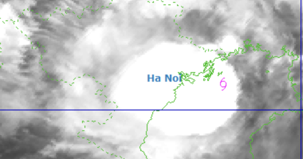
- The storm's center is located over the waters of Quang Ninh-Hai Phong, bringing strong winds and rough seas to the Gulf of Tonkin.
- Heavy rainfall poses a high risk of flash floods and landslides in several northern provinces, with potential flooding in low-lying areas.
Typhoon No. 4, named Narra, is currently bringing heavy rainfall to northern Vietnam, with seven provinces anticipated to be in the most affected areas on August 23-24. As of 7 a.m. on August 23, the storm's center was positioned over the waters of Quang Ninh and Hai Phong, approximately 100 km east of Quang Ninh and 120 km east of Hai Phong. The storm is moving slowly southwest at about 3 km/hour, with winds near the eye reaching level 8 (62-74 km/h) and gusts up to level 10.
Meteorologists describe the typhoon's behavior as complex and unusual, with its path constantly changing. "Since becoming Typhoon No. 4, its path has continuously changed, sometimes moving north, sometimes west, and since the night of August 22, it has shifted south," stated Nguyen Van Huong, head of the Weather Forecast Department at the National Center for Hydro-Meteorological Forecasting.
Over the next 24 hours, the typhoon is forecast to move east-southeast and exit the Gulf of Tonkin. However, its path may change again between 24-48 hours, potentially moving northeast, north, and eventually weakening into a tropical depression before making landfall in China's Guangxi province. The storm is causing widespread heavy rain in the northeastern region of Vietnam. The heaviest rainfall is expected in Cao Bang, Lang Son, Bac Ninh, Quang Ninh, and Hai Phong, with accumulations potentially reaching 100-200 mm and exceeding 300 mm in some areas by the end of August 24.
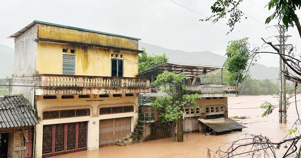
This prolonged heavy rainfall poses a high to very high risk of flash floods and landslides in several northern provinces, particularly Lang Son, Thai Nguyen, Cao Bang, Quang Ninh, and Bac Ninh. The typhoon is also expected to cause floods on rivers like Thuong, Luc Nam, and Thai Binh in Hai Phong; Trung, Ky Cung, and Bac Giang in Lang Son; Bang Giang in Cao Bang; and Cau in Thai Nguyen. Flood levels are predicted to reach alarm levels 2-3, with some areas exceeding level 3, increasing the risk of inundation in low-lying regions. Notably, 37 communes in Bac Ninh and 22 communes in Lang Son are at high risk of flooding.
Since becoming Typhoon No. 4, its path has continuously changed, sometimes moving north, sometimes west, and since the night of August 22, it has shifted south.
DistantNews Editorial
Originally published by Thanh Niên in Vietnamese. Translated, summarized, and contextualized by our editorial team with added local perspective. Read our editorial standards.
More Stories



From Our Blog

What Gets Lost (and Found) When News Is Translated

The Critical Role of Diaspora Media in Global News

What Travellers Should Know About Countries with Restricted Press

A Digital Nomad's Guide to Following Local News

How the Same Story Looks Different in Different Countries
