


UNAM to Expand Mexican Seismic Network with 58 New Stations
Translated from Spanish, summarized and contextualized by DistantNews.
At a glance
News
Sources not specified
Ongoing story
- UNAM will expand Mexico's Seismic Network with 58 new stations.
- The expansion aims to improve earthquake detection, localization, and magnitude estimation, especially in northern Mexico.
- A new intensity map system will provide near real-time information on areas experiencing strong seismic activity.
The National Autonomous University of Mexico (UNAM) is set to significantly enhance its seismic monitoring capabilities by expanding the Mexican Seismic Network with 58 new stations. This initiative will bolster the detection, localization, and magnitude estimation of earthquakes, with a particular focus on improving coverage in northern Mexico, a region historically less instrumented.
Of the new installations, 38 stations will be managed by UNAM's National Seismological Service (SSN) within the Institute of Geophysics. The remaining 20 will be operated by the Seismic Instrumentation Unit of the Institute of Engineering. Leonardo Ramírez Guzmán, coordinator of Seismological Engineering at the Institute of Engineering, stated that these new stations are currently under construction and will address both scientific and engineering needs, while also reducing uncertainty in determining earthquake locations and magnitudes.
A primary objective of the project is to reinforce monitoring in the northern part of the country, including the Baja California peninsula, Sonora, Chihuahua, Coahuila, and Nuevo León. This region, despite the perception of low seismic activity, does experience tremors that will now be identified and studied with greater precision. The expansion also includes adjustments to station distribution in central and southeastern Mexico, areas that currently have a higher concentration of equipment, such as Guerrero and Oaxaca.
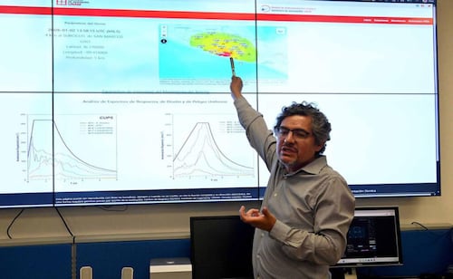
Beyond strengthening the monitoring network, the project introduces an intensity mapping system. This tool will provide information within minutes after an earthquake, identifying regions that experienced the strongest ground motion and indicating potential damage to homes and infrastructure. The first version of this platform is already available on the Mexican Seismic Network website, using color-coding to highlight areas with the most significant impact. This system was validated using data from the magnitude 6.5 earthquake in Guerrero on January 2nd, where its predictions closely matched reported damage.
The new stations are in the process of construction and will allow us to meet both scientific and engineering needs, as well as reduce uncertainty in the estimation of the magnitude and location of seismic events.
DistantNews Editorial
Originally published by El Universal in Spanish. Translated, summarized, and contextualized by our editorial team with added local perspective. Read our editorial standards.
More Stories



From Our Blog

What Press Freedom Means for the News You Read

What Gets Lost (and Found) When News Is Translated

The Critical Role of Diaspora Media in Global News

What Travellers Should Know About Countries with Restricted Press

A Digital Nomad's Guide to Following Local News
