


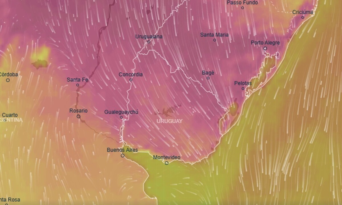
Warm spell ends in Uruguay with sharp temperature drop, rain, and storms forecast
Translated from Spanish, summarized and contextualized by DistantNews.
At a glance
News
Sources not specified
Context piece
- Uruguay is experiencing a sharp temperature drop, ending a period of warm weather, with rain and storms expected.
- Temperatures will fall significantly over the weekend, with a more than ten-degree Celsius decrease.
- Heavy rainfall and storms are forecast for several regions, with some areas expecting up to 120 mm of precipitation.
Uruguay is bracing for a dramatic shift in weather as a warm spell gives way to cooler temperatures, accompanied by rain and thunderstorms. Meteorologists predict the end of the "veranillo," or Indian summer, with a significant temperature drop expected over the weekend.
Friday will see highs of 25°C in Montevideo and up to 30°C in the north. However, this warmth is fleeting. Temperatures are set to plummet by more than ten degrees Celsius across the country by Sunday. The decline will occur in two stages: a slight drop on Saturday, followed by a more substantial decrease on Sunday.
This change comes as intense weather patterns bring rain and storms to various parts of the country, a situation expected to persist until at least Monday. Rocha has recorded the highest rainfall accumulation so far. Montevideo experienced 28.7 mm of rain on Thursday, with Santa Teresa recording 21.3 mm.
The forecast for Montevideo includes overcast skies and deteriorating conditions with precipitation and storms on Friday, though temporary improvements are possible. Saturday will see a maximum temperature of 20°C and a minimum of 12°C, with continued rain and storms. By Sunday, rainfall in the capital is expected to be scarce, but it will feel colder with a minimum of 10°C and a maximum of 13°C, amplified by strong southerly winds. High chances of rain return on Monday, with temperatures ranging from 10°C to 14°C.
Meteorological warnings highlight the potential for severe thunderstorms with heavy rainfall, particularly in the center, east, and north of the country, with accumulated rainfall estimated between 40 and 80 mm for Thursday and Friday. From Saturday through Monday afternoon, a semi-stationary front is expected to affect the north, bringing strong storms and copious precipitation, with accumulations potentially reaching 80 to 120 mm, and even higher in some spots. These storms may include strong wind gusts, hail, and intense electrical activity.
DistantNews Editorial
Originally published by El País in Spanish. Translated, summarized, and contextualized by our editorial team with added local perspective. Read our editorial standards.
More Stories



From Our Blog

What Gets Lost (and Found) When News Is Translated

The Critical Role of Diaspora Media in Global News

What Travellers Should Know About Countries with Restricted Press

A Digital Nomad's Guide to Following Local News

How the Same Story Looks Different in Different Countries
