

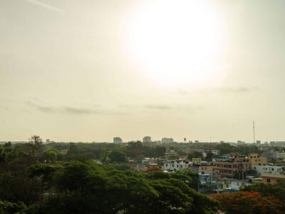

Dominican Republic braces for heat, Saharan dust, and incoming tropical wave
Translated from Spanish, summarized and contextualized by DistantNews.
At a glance
News
Named sources
Context piece
- The Dominican Republic will experience hot, mostly sunny, and slightly hazy weather on Saturday due to Saharan dust and dry air.
- Isolated afternoon showers are possible in some areas, but widespread rain is not expected until Sunday with the arrival of a tropical wave.
- Maritime conditions will worsen Sunday as the tropical wave brings increased winds, showers, and rough seas.
Dominicans can expect a hot and predominantly sunny Saturday, with a slight haze from Saharan dust and dry air contributing to minimal rainfall. Temperatures are forecast to reach between 32°C and 34°C, potentially climbing to 35°C-36°C in the Cibao region, border areas, and interior valleys. The National Institute of Meteorology (Indomet) advises limiting prolonged sun exposure between 11 a.m. and 4 p.m.
While most of the country will remain dry, brief, isolated showers may occur in the afternoon in the Cibao Valley, Central Mountain Range, northeast, southeast, and border regions. These are attributed to daytime heating and orographic effects. A significant change in weather patterns is anticipated for Sunday with the approach of a tropical wave.
Indomet predicts heavier rains, thunderstorms, and gusty winds starting Sunday morning along the southern coast and in Greater Santo Domingo. By the afternoon, these conditions are expected to spread to Monte Plata, Monseñor Nouel, La Vega, and nearby areas. Greater Santo Domingo will see increasing cloudiness and showers on Sunday after a mostly sunny and hazy Saturday. Santiago will experience very hot conditions, with temperatures between 34°C and 36°C, and a slight chance of a brief afternoon shower near the Central Mountain Range.
The National Emergency Operations Center (COE) has lifted previous green alerts in four provinces due to reduced rainfall. However, maritime conditions are set to deteriorate. The approaching tropical wave will increase winds, showers, and wave action in the eastern Caribbean and Greater Antilles starting Saturday night and continuing through Sunday. Small craft operators on the Atlantic coast are advised to exercise caution due to abnormal wave episodes and expected deterioration. The Caribbean coast will be more manageable on Saturday but may worsen Sunday due to the tropical wave's associated gusts and storms.
DistantNews Editorial
Originally published by Diario Libre in Spanish. Translated, summarized, and contextualized by our editorial team with added local perspective. Read our editorial standards.
More Stories

From Our Blog

What Gets Lost (and Found) When News Is Translated

The Critical Role of Diaspora Media in Global News

What Travellers Should Know About Countries with Restricted Press

A Digital Nomad's Guide to Following Local News

How the Same Story Looks Different in Different Countries
