


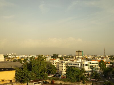
Dominican Republic forecasts hot weather, few rains amid Saharan dust
Translated from Spanish, summarized and contextualized by DistantNews.
At a glance
News
Official statement
Context piece
- The Dominican Republic can expect hot weather and minimal rain due to Saharan dust, reduced humidity, and a departing weather system.
- The National Meteorology Institute (Indomet) forecasts higher temperatures and recommends precautions like drinking water and wearing light clothing.
- Two tropical waves are being monitored for potential development, with one showing a 30% chance of cyclonic development in the coming days.
The Dominican Republic is bracing for a hot and dry spell, with the National Meteorology Institute (Indomet) forecasting scant rainfall and a generally overcast sky for Friday. This weather pattern is attributed to Saharan dust concentrations, reduced humidity, and the westward movement of a weather trough.
Indomet anticipates only isolated showers during the afternoon, primarily over the Central Mountain Range and the border region. The institute predicts an increase in temperatures due to clear skies allowing for greater solar radiation, complemented by warm, humid winds from the east-southeast, typical for this time of year. Residents are advised to stay hydrated, wear light-colored, loose clothing, avoid direct sun exposure between 11 a.m. and 4 p.m., and seek cool, ventilated areas. Children, the elderly, and pregnant women are particularly vulnerable to heat effects, with minimum temperatures ranging from 24-26°C and maximums between 32-34°C.
Looking ahead, Saturday is expected to see continued dry conditions across most of the country, with Saharan dust and low humidity limiting precipitation. However, brief afternoon showers might occur in parts of the Cibao Valley, Central Mountains, northeast, and southeast due to tropical warmth and local geography. Sunday, Restoration Day, is forecast to bring increased humidity and instability as one of the monitored tropical waves approaches. Morning cloudiness, local showers, and thunderstorms are expected along the southern coast and in the Greater Santo Domingo area, with precipitation intensifying in the afternoon over Monte Plata, Monseñor Nouel, La Vega, and nearby provinces.
Indomet is closely monitoring two disorganized areas of showers and thunderstorms associated with tropical waves. The first is located less than 1,000 kilometers east of the Lesser Antilles, with its cyclonic development probability reduced to 30% over the next seven days. The second system is several hundred kilometers southwest of the Cape Verde islands, maintaining a 30% development chance for the next two days and a 50% chance within seven days. Both systems are under constant observation due to their positions and evolving patterns.
DistantNews Editorial
Originally published by Diario Libre in Spanish. Translated, summarized, and contextualized by our editorial team with added local perspective. Read our editorial standards.
More Stories

From Our Blog

What Gets Lost (and Found) When News Is Translated

The Critical Role of Diaspora Media in Global News

What Travellers Should Know About Countries with Restricted Press

A Digital Nomad's Guide to Following Local News

How the Same Story Looks Different in Different Countries
