



Dominican Republic's COE activates contingency plan for incoming tropical wave
Translated from Spanish and summarized by DistantNews. Read the original for the full story.
At a glance
News
Named sources
Ongoing story
- The Dominican Republic's Emergency Operations Center (COE) has activated its contingency plan due to an approaching tropical wave expected to bring significant rainfall starting Sunday.
- The activation aims to prepare response institutions and pre-position resources in potentially affected areas.
- Meteorologists predict accumulated rainfall between 50 to 75 millimeters, primarily affecting the east and northeast regions initially, with potential spread to other areas.
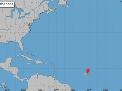
The Emergency Operations Center (COE) in the Dominican Republic has activated its contingency plan in anticipation of heavy rainfall from an active tropical wave forecast to arrive Sunday afternoon and evening. This proactive measure is being taken in response to predictions of prolonged rainfall over several days.
COE Director Erdwin Olivares emphasized that the activation seeks to prepare the institutions involved in the response system well in advance. The goal is to ensure resources can be reinforced or strategically positioned in areas likely to be impacted. Olivares stressed that the plan is not intended to cause alarm but to keep the public informed and vigilant throughout the weekend.
Meteorologists from the Dominican Institute of Meteorology (Indomet) are closely monitoring the phenomenon. Gloria Ceballos, Indomet's executive director, stated that the tropical wave is expected to cause increased rainfall across the national territory, particularly from Sunday afternoon through Tuesday. Indomet models project rainfall accumulations ranging from 50 to 75 millimeters (2 to 3 inches) during the peak period.
The initial impact is expected in the eastern and northeastern parts of the country due to the wave's west-to-east movement. Subsequently, the rainfall may extend to other regions, including the Central Mountain Range, the north, and the southeast. The COE will begin issuing relevant weather alerts starting Saturday, depending on the evolving meteorological conditions, urging the public to follow official channels for updates.
We wanted to work today, on a Friday, well in advance to bring this message to the citizens.
About this summary
Originally published by Diario Libre in Spanish. Translated, summarized, and contextualized automatically by DistantNews, with a note on how the source frames the story. Not individually reviewed before publishing. How this works.
More Stories
From Our Blog

What Gets Lost (and Found) When News Is Translated

The Critical Role of Diaspora Media in Global News

What Travellers Should Know About Countries with Restricted Press

A Digital Nomad's Guide to Following Local News

How the Same Story Looks Different in Different Countries
