


Drought relief uncertain as heat breaks, 'Chan-hom' moisture a variable
Translated from Korean, summarized and contextualized by DistantNews.
At a glance
News
Sources not specified
Context piece
- South Korea experienced extreme heatwaves, but the focus has shifted to whether drought conditions in the southern regions will ease by the end of August.
- Rain is expected in coastal areas, the southern region, and Jeju Island this week, with potential influence from Typhoon Chan-hom's moisture.
- However, current rainfall forecasts are insufficient to alleviate the drought, and the extent of relief depends on the amount and location of future precipitation.
While the most extreme heatwaves have subsided in South Korea around the start of autumn, attention is now turning to whether the drought gripping the southern regions can be resolved before the end of August.
This week, rain is anticipated along the eastern coast, in the southern provinces, and on Jeju Island. The moisture left by Typhoon Chan-hom is also expected to play a role in the weather patterns. However, the current forecast suggests that the amount of rainfall will be limited and vary significantly by region, making it difficult to expect immediate drought relief. The situation regarding the drought until the end of August will largely depend on where and how much rain falls.
According to the Korea Meteorological Administration, light to moderate rain is expected in some areas from Wednesday. The eastern coast of Gangwon Province and its mountainous areas could receive 5 to 20 millimeters of rain. By Thursday, rain will continue along the eastern coast of Gangwon and Gyeongbuk provinces, with some areas in Busan, Ulsan, and eastern Gyeongnam experiencing rain in the afternoon. Showers are also possible in parts of Chungcheong and inland southern regions. On Friday, Gangwon's Yeongdong region will see rain, and most of the country could experience scattered showers. Jeju Island is expected to have rain starting in the afternoon and continuing through the weekend.
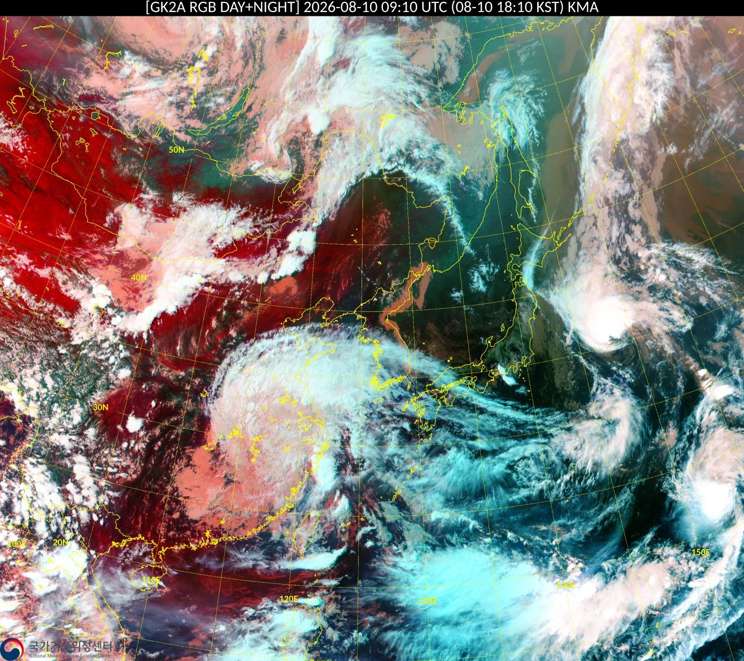
Despite intermittent rain, the volume is unlikely to be enough to end the drought, as widespread and continuous rain is not predicted for the drought-stricken southern areas. A key variable is Typhoon Chan-hom, which was moving north from waters east of Tokyo on Sunday. It is expected to weaken rapidly after passing near Japan on Monday and moving into the East Sea on Tuesday. While the typhoon's direct wind impact is not anticipated to reach the Korean Peninsula, the moisture it carries could influence rainfall along the eastern coast and surrounding weather systems. The exact location where the weakened typhoon's remnants make landfall will determine the extent of the rainfall.
Even with the easing of extreme heat, temperatures are expected to remain high, with daytime highs reaching 34 degrees Celsius on Monday and Tuesday, and up to 35 degrees Celsius from Wednesday to Thursday. Similar temperatures are forecast for the weekend and into the following week. Heatwave advisories remain in effect for some areas, and the highest perceived temperatures could reach around 33 degrees Celsius. Tropical nights are also possible in urban and coastal areas. Ultimately, while the intense heat has broken, the question of whether the drought will also end by late August remains uncertain, hinging on the concentration and volume of future rainfall.
DistantNews Editorial
Originally published by Dong-A Ilbo in Korean. Translated, summarized, and contextualized by our editorial team with added local perspective. Read our editorial standards.
More Stories


From Our Blog

What Gets Lost (and Found) When News Is Translated

The Critical Role of Diaspora Media in Global News

What Travellers Should Know About Countries with Restricted Press

A Digital Nomad's Guide to Following Local News

How the Same Story Looks Different in Different Countries
