


El Niño to Have 'Conditions Never Seen Before,' Meteorologist Warns
Translated from Spanish, summarized and contextualized by DistantNews.
At a glance
News
Sources not specified
Context piece
- Meteorologists warn that the current El Niño phenomenon is developing under "conditions that have potentially never been seen before."
- Climate models project extreme intensity, with sea surface temperatures in the Niño 3.4 region potentially reaching +3.9°C in December, significantly exceeding previous records.
- The UN also anticipates a "strong" El Niño episode, increasing the likelihood of extreme weather events like heatwaves, droughts, and intense rainfall globally.
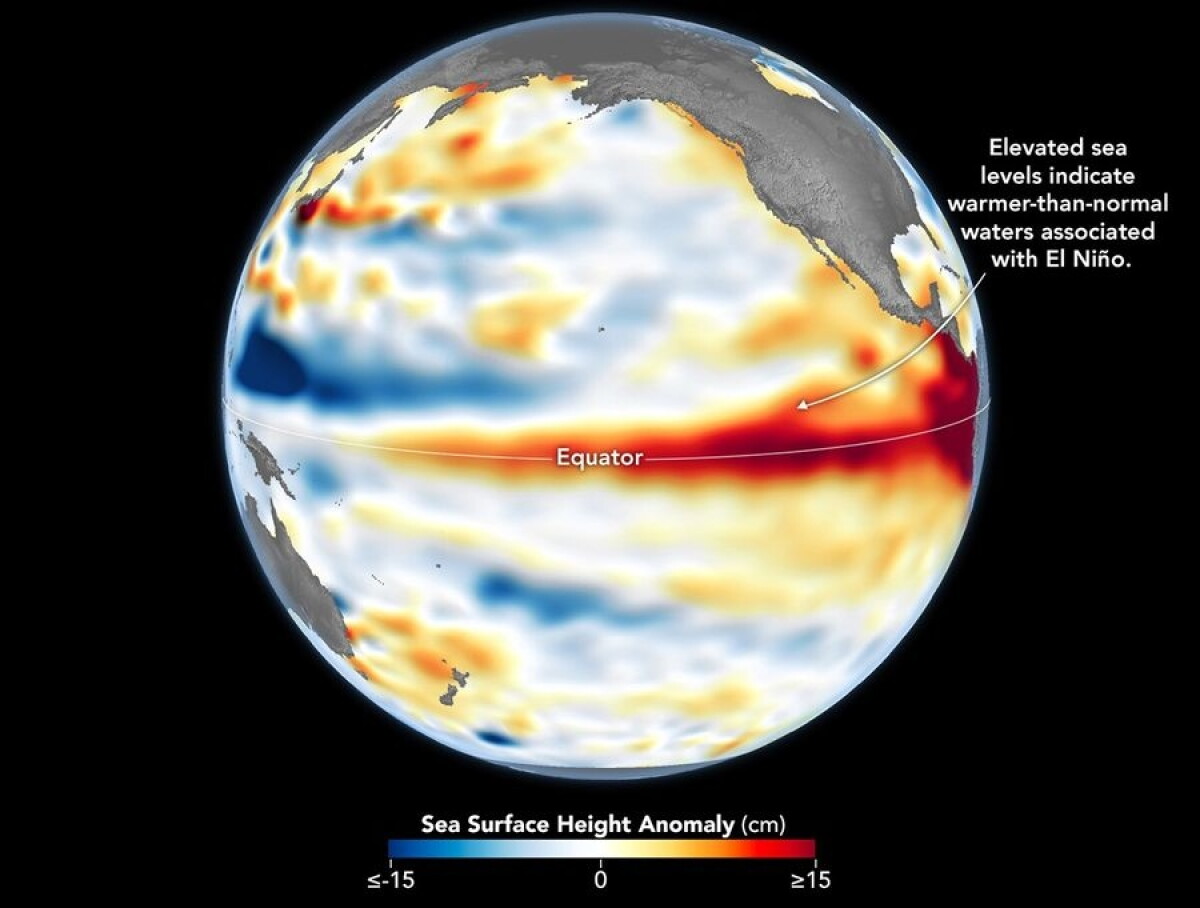
The El Niño phenomenon, which has already begun, is developing under "conditions that potentially never before have been seen," according to meteorologist Luiz F. Nachtigall of Brazil's Metsul agency. Projections from climate models indicate an "extreme" scenario, with unprecedented intensity.
Nachtigall highlighted that data has never before suggested a remotely similar intensity for an El Niño episode, even compared to the most severe ones in 1982-83, 1997-98, and 2015-16. Updated data from the ECMWF's Sazona model points to an extreme thermal anomaly of approximately +3.9°C in the Niño 3.4 region of the central-eastern equatorial Pacific during December. This projected temperature is about 1.1°C higher than the 2015 record, representing a "gigantic change in the amount of heat stored in the tropical Pacific" with the potential for profound alterations in global atmospheric circulation.
Concerns are amplified by corroborating simulations from other major climate systems. The North American NOAA FV3 SFSv1.1 Beta system, the CFSv2 model, and France's Météo-France S9 system all show robust agreement in their medium-term projections for the final quarter of the year. This mathematical consensus among independent models confirms that oceanic and atmospheric conditions are aligning to generate one of the most significant climatic disturbances in recent decades.
Adding to the global concern, a UN report anticipates that El Niño will intensify into a "strong episode" between July and September. This intensification raises the probability of widespread extreme weather events, including heatwaves, droughts, and heavy rainfall across various regions. El Niño naturally elevates water temperatures in the central and eastern equatorial Pacific, altering global wind, pressure, and precipitation patterns. Typically occurring every two to seven years, it lasts about nine to twelve months, according to the World Meteorological Organization.
DistantNews Editorial
Originally published by El País in Spanish. Translated, summarized, and contextualized by our editorial team with added local perspective. Read our editorial standards.
More Stories



From Our Blog

What Gets Lost (and Found) When News Is Translated

The Critical Role of Diaspora Media in Global News

What Travellers Should Know About Countries with Restricted Press

A Digital Nomad's Guide to Following Local News

How the Same Story Looks Different in Different Countries
