


‘Glacier tsunami’ hit Chinese border checkpoint at 19 metres per second, study finds
Translated from Korean and summarized by DistantNews. Read the original for the full story.
At a glance
News
Documents & data
Outcome reported
- A Chinese Academy of Sciences team estimated that the flood and debris flow that hit a border checkpoint moved at up to 19 metres per second.
- Researchers described the disaster as a chain of glacier collapse, debris-flow landslide and flooding, leaving little time for an effective response.
- They recommended upstream monitoring, remote sensing, water-level measurements and seismic data to improve early warnings.
The flood that swept into a Chinese border checkpoint after a glacier collapse in the Nepal-Tibet region moved at up to 19 metres per second, according to researchers from the Chinese Academy of Sciences.
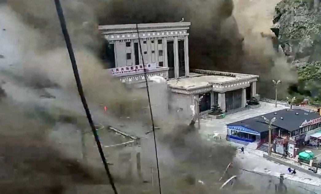
The speed was nearly twice Usain Bolt’s average pace when he set the 100-metre world record of 9.58 seconds in 2009. Video released after the event showed a high-rise building at the checkpoint in China’s Gyirong County collapsing and being carried away, illustrating the force of the so-called glacier flood tsunami.
The research team reconstructed the disaster in a paper published online in the Chinese journal Yangtze River. It described the event as a linked process that began with a glacier collapse, continued through an avalanche of ice and rock and a debris-flow landslide, and ended in flooding.
This disaster was a continuous process that progressed from glacier collapse through a debris-flow landslide and finally to flooding.
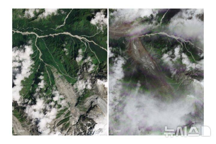
The collapse occurred at Langtang Lirung on the Nepalese side of the Himalayan border. The mixture of ice, rock and debris reached Gyirong Port, about 22 kilometres away, before continuing downstream. Researchers calculated that the flood was still moving at a surface speed of about 11.7 metres per second when it reached a bridge on Nepal’s Trishuli River, 52 kilometres from the checkpoint.
That speed would put the travel time to the bridge at between 46 and 75 minutes, although the researchers said actual warning time would depend on monitoring, communications and response capacity. They recommended tracking glacier movement and issuing warnings as early as possible, using monitoring points farther upstream together with remote sensing, water-level readings and seismic data.
The report also noted that Chinese scientists had warned a year earlier about flood risks in the area after a bridge at the checkpoint was destroyed when a natural dam holding back a glacial lake collapsed. Those scientists examined rising lake levels linked to climate change and warned of further incidents upstream, but did not investigate the possibility of a glacier collapse.
The time from the glacier collapse to reaching Gyirong Port was extremely short, and the effective response time was limited.
About this summary
Originally published by Dong-A Ilbo in Korean. Translated, summarized, and contextualized automatically by DistantNews, with a note on how the source frames the story. Not individually reviewed before publishing. How this works.
More Stories


From Our Blog

What Gets Lost (and Found) When News Is Translated

The Critical Role of Diaspora Media in Global News

What Travellers Should Know About Countries with Restricted Press

A Digital Nomad's Guide to Following Local News

How the Same Story Looks Different in Different Countries
