

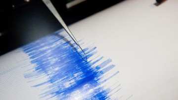

Magnitude 7.7 Earthquake Shakes East Nusa Tenggara, BMKG Issues Tsunami Warning
Translated from Indonesian, summarized and contextualized by DistantNews.
At a glance
News
From a news agency
Ongoing story
- A magnitude 7.7 earthquake struck Nagekeo, East Nusa Tenggara, Indonesia, prompting the Meteorology, Climatology, and Geophysics Agency (BMKG) to issue tsunami warnings.
- The earthquake's epicenter was located about 30 kilometers offshore, with a depth of 15 kilometers.
- Tsunami warnings, including 'Alert Level 2,' were issued for coastal areas in East Nusa Tenggara, South Sulawesi, West Nusa Tenggara, and Southeast Sulawesi.
A powerful magnitude 7.7 earthquake jolted the region of Nagekeo in East Nusa Tenggara, Indonesia, on Saturday morning, prompting the Meteorology, Climatology, and Geophysics Agency (BMKG) to issue tsunami warnings for several coastal areas.
The earthquake's epicenter was situated approximately 30 kilometers off the coast of Mbay-Nagekeo, at a depth of 15 kilometers, according to BMKG's Kupang Geophysics Station Chief Arief Tyastama. The seismic event occurred at 8.41 degrees latitude south and 121.39 degrees longitude east.
By 7:03 AM local time, BMKG had issued 'Early Warning Tsunami 2' for potentially affected regions. In East Nusa Tenggara, areas under 'Alert' status included northern parts of Manggarai, Ngada, West Manggarai, Ende, and Sikka. In South Sulawesi, the alert extended to Selayar, Jeneponto, and Bantaeng.
Earlier, following an initial magnitude 7.0 earthquake, BMKG had issued 'Early Warning Tsunami 1.' At that time, northern Ngada was placed on 'Watch' status, with an estimated tsunami arrival time of 5:01:23 AM WIB. As of 7:02 AM local time, aftershocks continued to be felt across Flores Island and parts of Sumba, Adonara, and Solor islands.
The location is around 30 kilometers sea from Mbay-Nagekeo with a depth of 15 kilometers.
DistantNews Editorial
Originally published by Republika in Indonesian. Translated, summarized, and contextualized by our editorial team with added local perspective. Read our editorial standards.
More Stories


From Our Blog

What Gets Lost (and Found) When News Is Translated

The Critical Role of Diaspora Media in Global News

What Travellers Should Know About Countries with Restricted Press

A Digital Nomad's Guide to Following Local News

How the Same Story Looks Different in Different Countries
