

Northern Vietnam Rivers Nearing Historic Flood Levels Amidst Typhoon Noru
Translated from Vietnamese, summarized and contextualized by DistantNews.
At a glance
News
Sources not specified
Ongoing story
- Several rivers in Northern Vietnam are forecast to exceed historical flood levels due to Typhoon Noru.
- Heavy rainfall is expected in the Northeast region, southern Phu Tho, and Thanh Hoa provinces on August 23-24.
- Floodwaters on rivers like the Trung and Ky Cung have already surpassed alert level 3, with further rises predicted.
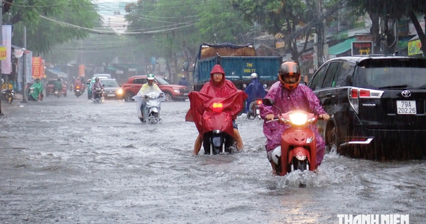
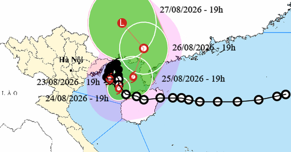
Northern Vietnam is bracing for potentially historic floods as several rivers are predicted to surge beyond previous records. The national meteorological and hydrological forecasting center warned of continued heavy rainfall from August 23 to 24, particularly in the Northeast region, southern Phu Tho, and Thanh Hoa provinces, influenced by Typhoon Noru's slow movement offshore. Some areas could receive over 250 mm of rain.
As of August 23, floodwaters on numerous rivers in the Northeast have reached critical levels. The Trung River at Huu Lung is flowing at 20.79 meters, exceeding alert level 3 by 1.79 meters. Similarly, the Ky Cung River at Lang Son is at 256.41 meters, 0.41 meters above alert level 3. Other rivers, including the Bac Giang, Luc Nam, and Thuong, are also experiencing high water levels, with some exceeding alert levels.
Forecasts indicate that river levels will continue to rise through August 24. The Trung River is expected to reach 21.20 meters, significantly above alert level 3, though still below its 2025 peak. The Ky Cung River is also projected to rise further, surpassing its 2025 peak by 3.40 meters. While heavy rainfall is expected to gradually decrease from August 24, the immediate threat of severe flooding remains high across the region.
DistantNews Editorial
Originally published by Thanh Niên in Vietnamese. Translated, summarized, and contextualized by our editorial team with added local perspective. Read our editorial standards.
More Stories
From Our Blog

What Gets Lost (and Found) When News Is Translated

The Critical Role of Diaspora Media in Global News

What Travellers Should Know About Countries with Restricted Press

A Digital Nomad's Guide to Following Local News

How the Same Story Looks Different in Different Countries
