




Red River Planning Update: Which Villages Will Move, and Which Will Stay?
Translated from Vietnamese and summarized by DistantNews. Read the original for the full story.
At a glance
News
Official statement
New plan
- Hanoi is revising the 1:5,000 zoning plan for a roughly 40-kilometer section of the Red River corridor covering 16 communes and wards and about 11,418 hectares.
- The plan prioritizes flood safety, preserves flood-discharge space and proposes parks, transport links, public facilities and climate-adaptation measures.
- Traditional villages will be relocated, rebuilt or selectively renovated, while historic and cultural sites and the cores of traditional craft villages will be preserved.
Hanoi is redrawing its vision for the Red River corridor, but the plan does not treat every riverside village in the same way. Existing villages and residential areas will be divided into three groups: those to be relocated, those to be rebuilt, and those to undergo selective renovation and improvement.
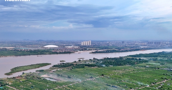
The revised 1:5,000 urban zoning plan covers a study area about 40 kilometers long, running northwest to southeast between Hong Ha Bridge and Me So Bridge. It passes through 16 communes and wards and covers about 11,418 hectares between the river’s left and right-bank dikes.
Hanoi says the central rule is to avoid narrowing the river’s flood-discharge space and not to propose new dikes inside existing ones. Landscape structures will use removable architectural modules, while terraced ecological flood defenses and rain gardens will help retain sediment and protect the dike system. The proposed road route will follow existing dikes to use current infrastructure and meet flood-prevention standards.
The riverbanks are planned as a defining green-corridor landscape, with special flood-discharge zones and measures for climate-change and disaster adaptation. The plan also envisions parks, walking paths, community spaces, sports and cultural facilities, festival areas and riverside scenery. Roads, bridges and waterways would be linked into a continuous network, improving travel between the two banks and connecting riverside areas with other developing parts of the city.
The study area is projected to house between 800,000 and 1.2 million people. Most buildings would stand between 30 and 45 floors, while traditional villages are expected to remain at three floors, subject to detailed project assessments. A landmark, the 109-story Era Tower, is also proposed. Construction and elevation of riverbank areas would cover about 3,900 hectares.
The plan calls for Hanoi to preserve, repair and improve longstanding villages containing historic and cultural relics, memorial sites and locations linked to revolutionary and resistance-era events. The area includes 123 relic sites, both officially classified and unclassified, tied to local communities. The city also intends to preserve the cores of traditional craft villages and villages recognized for their architectural, historical or tangible and intangible cultural value.
About this summary
Originally published by Tuổi Trẻ in Vietnamese. Translated, summarized, and contextualized automatically by DistantNews, with a note on how the source frames the story. Not individually reviewed before publishing. How this works.
More Stories
From Our Blog

News in Translation: What Gets Lost, and How We Keep the Framing

Diaspora Media: How Communities Follow News From Home

Traveling Where the Press Is Not Free: How to Read the News There

The Digital Nomad's Guide to Local News

The Same Story, Different Countries: How Coverage Changes at the Border
