
Waghäusel's Heat Records Explained: Why Germany's Town Often Tops Temperature Charts
Translated from German, summarized and contextualized by DistantNews.
At a glance
News
From a news agency
Context piece
- Waghäusel, Germany, has recorded the highest temperatures in Baden-Württemberg for the past three years due to its low elevation and location in the Upper Rhine Plain.
- German Weather Service expert Hanns Ulrich Kümmerle explained that descending winds from the Palatinate Forest warm up as they drop into the Rhine Valley, further heating up in urban areas and near farmland before reaching Waghäusel.
- The placement of the weather station within the town, rather than in an open area, also contributes to higher recorded temperatures, a compromise made for practical reasons like electricity and internet access.
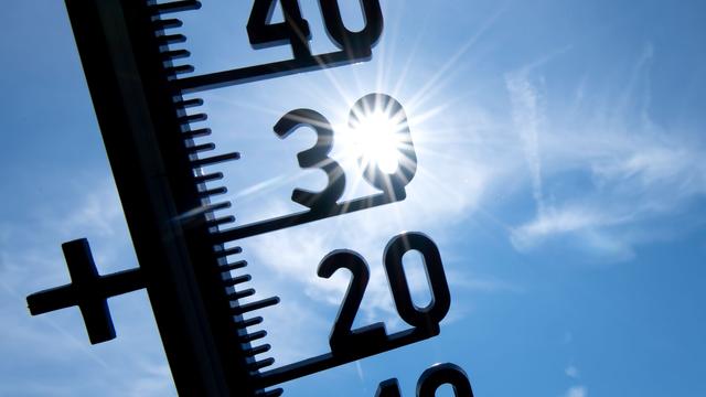
Waghäusel, a town in Germany's Karlsruhe district, has repeatedly registered record-breaking temperatures, becoming the site of Baden-Württemberg's highest annual temperatures for the past three years. This phenomenon is attributed to a combination of geographical and meteorological factors, according to Hanns Ulrich Kümmerle from the German Weather Service (DWD).
And, from about 400 to 600 meters high, it sinks into the Rhine Valley. And when the pressure increases during this descent, the temperature also increases by a flat one degree per hundred meters.
The town's low elevation within the Upper Rhine Plain plays a significant role. Typically, west winds in Central Europe pass over the Palatinate Forest, and upon reaching the edge of the forest, the air descends into the Rhine Valley. Kümmerle explained that this descent, from an altitude of 400 to 600 meters, causes the air pressure to increase, which in turn raises the temperature. For instance, air that is already 30 degrees Celsius at altitude can become 34 degrees Celsius upon reaching the valley floor.
This means that if the air upstairs is already 30 degrees warm, for example, and it sinks 400 meters into the Rhine plain, the air temperature down here is already 34 degrees, according to Kümmerle.
Further warming occurs as this air moves over agricultural land and then into Waghäusel itself. The urban environment, with its buildings and paved surfaces, absorbs and retains heat, pushing temperatures from around 34 degrees Celsius to 35 or 36 degrees Celsius. This urban heat island effect is a key contributor to the town's frequent heat records.
From 34 degrees, it can then become 35 or 36 degrees.
An additional factor is the specific location of the DWD weather station. Unlike stations placed in open fields outside urban areas, the Waghäusel station is situated in the Kirrlach district, within a residential zone. Kümmerle noted that if the station were in Mannheim's city center, those records might be set there instead. The placement in Waghäusel was a practical decision, as operating a station requires reliable access to electricity and internet, which were not feasible in a more remote location. This makes the current site a "second-best solution."
as a second-best solution
DistantNews Editorial
Originally published by Die Zeit in German. Translated, summarized, and contextualized by our editorial team with added local perspective. Read our editorial standards.
More Stories


From Our Blog

What Gets Lost (and Found) When News Is Translated

How the Same Story Looks Different in Different Countries

The Critical Role of Diaspora Media in Global News

What Travellers Should Know About Countries with Restricted Press

A Digital Nomad's Guide to Following Local News
