


Why Nepal’s infrastructure keeps getting devoured by rivers
Summarized by DistantNews. Read the original for the full story.
At a glance
News
Sources not specified
Context piece
- Nepal's infrastructure is repeatedly destroyed by rivers due to a failure to plan for extreme weather events, instead relying on historical averages.
- Planners use statistical means for designs, ignoring the increased variance and extreme events caused by climate change, which standard engineering practices fail to address.
- This statistical blind spot leads to recurrent infrastructure failures, devastating public budgets and crippling communities, as structures built for average conditions are washed away by outliers.
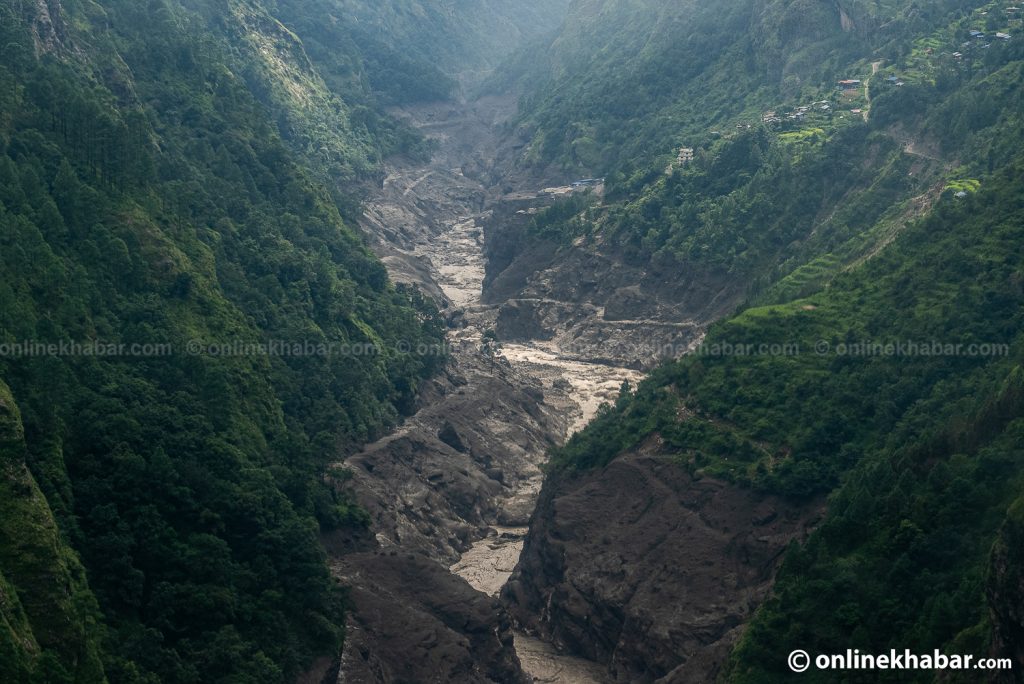
A recent devastating flood in the Bhotekoshi riverbed, which swept through Timure and Syabrubesi on August 26, destroyed settlements, customs infrastructure, police posts, hydropower facilities, and newly completed bridges along Nepal's primary trade route. While official reports may cite an 'unprecedented hydrological surge,' the repeated nature of such events in the same landscape points to a persistent failure in planning and foresight.
But when an event hits the same landscape more than once in a decade, calling it a ‘surprise’ is just poor planning and shortsightedness.
The core issue lies in Nepal's approach to infrastructure development, which relies heavily on statistical averages and central tendencies found in strategic documents. Planners model projects around mean annual rainfall, baseline temperature increases, and average river discharges, creating neat, predictable designs for budget cycles. However, Nepal's volatile geography does not conform to these averages. Extreme events, such as high-altitude glacial lake outbursts releasing massive volumes of water in minutes, are not captured by these predictable trendlines.
We are building a country for a climate that no longer exists.
Climate change exacerbates this problem by increasing variance in weather patterns, stretching the distance between expected means and destructive tail events. Standard engineering practices in Nepal design structures based on historical averages, like the 30-year mean flood level. This approach overlooks the significant threat posed by the standard deviation, the measure of how extreme events deviate from the average. Infrastructure built to withstand the mean is inherently vulnerable to statistical outliers, which are becoming more frequent.
Means make complex landscape systems look neat on paper. They let us draw predictable trendlines into five-year project budgets.
This statistical blind spot has severe consequences, draining public budgets and leaving thousands struggling to recover from disasters. When intense storms or glacial lake outbursts occur, structures engineered for historical medians are overwhelmed. Drains overflow, culverts fail, and retaining walls collapse. Rebuilding the same infrastructure without accounting for increased variance means the cycle of destruction and rebuilding will inevitably continue, highlighting a critical need for updated planning and engineering standards that incorporate climate change realities.
Nepal’s geography, however, does not care about averages.
About this summary
Originally published by Kathmandu Post. Summarized and contextualized automatically by DistantNews, with a note on how the source frames the story. Not individually reviewed before publishing. How this works.
More Stories


From Our Blog

What Gets Lost (and Found) When News Is Translated

The Critical Role of Diaspora Media in Global News

What Travellers Should Know About Countries with Restricted Press

A Digital Nomad's Guide to Following Local News

How the Same Story Looks Different in Different Countries
