


Over 2.5 km of potential Inca roads found near Machu Picchu using LiDAR
Translated from Spanish, summarized and contextualized by DistantNews.
At a glance
News
Sources not specified
Context piece
- A new exploration near Machu Picchu using LiDAR technology has revealed over 2.5 kilometers of potential pre-Hispanic roads.
- The findings also include platforms and terraces that could offer new insights into Inca land organization.
- Further field research by archaeologists is required to confirm the age and function of these newly identified structures.
An archaeological exploration in the vicinity of Machu Picchu has uncovered more than 2.5 kilometers of potential pre-Hispanic roads, alongside platforms and terraces. These discoveries, made possible by LiDAR technology, may shed new light on how the Incas organized and inhabited the region.
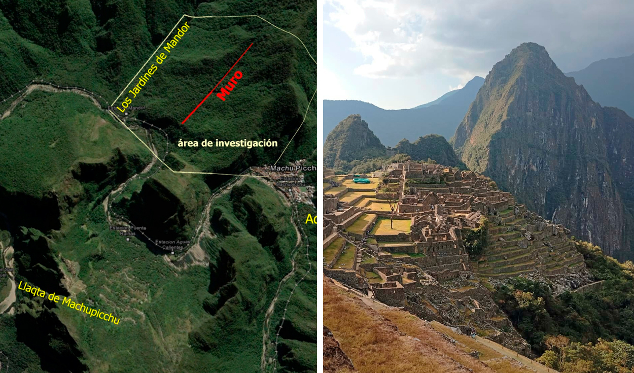
The findings were detected in July near the Mandor wall, east of the Inca citadel. Among the most significant discoveries is a potential zigzagging route spanning at least 1.2 kilometers, exhibiting characteristics consistent with Inca construction techniques. The exploration also identified possible platforms and terraces in an area densely covered by vegetation and characterized by rugged terrain, making ground-level identification of archaeological structures difficult.
LiDAR technology, which uses laser pulses to measure distances and create detailed terrain models, proved crucial in identifying these hidden modifications to the landscape. While the technology can reveal potential structures, specialists emphasize that field investigations are necessary to confirm their pre-Hispanic origin and function. The Decentralized Directorate of Culture (DDC) of Cusco has announced that archaeological prospection, registration, and verification work will be carried out to assess the structures and determine necessary conservation measures.
This research, a collaboration between the DDC Cusco and the Center for Andean Studies at the University of Warsaw, could significantly expand knowledge of the extensive network of roads and spaces that connected the cultural landscape of Machu Picchu. The potential 1.2-kilometer route in the Mandor area is particularly noteworthy for its zigzagging design, though confirmation of its Inca period origin awaits further archaeological study. The results are expected to guide future research and conservation efforts in vegetated areas surrounding Machu Picchu.
DistantNews Editorial
Originally published by La República in Spanish. Translated, summarized, and contextualized by our editorial team with added local perspective. Read our editorial standards.
More Stories



From Our Blog

What Gets Lost (and Found) When News Is Translated

The Critical Role of Diaspora Media in Global News

What Travellers Should Know About Countries with Restricted Press

A Digital Nomad's Guide to Following Local News

How the Same Story Looks Different in Different Countries
