


South Kalimantan Records 473 Hotspots as BMKG Warns of Very High Fire Risk
Summarized and contextualized by DistantNews.
At a glance
News
Named sources
Context piece
- South Kalimantan has detected 473 hotspots, with the highest concentrations in Hulu Sungai Selatan, Tapin, and Banjar regencies.
- The Indonesian Meteorology, Climatology, and Geophysics Agency (BMKG) warns that nearly all areas are in a "red zone" with a very high risk of forest and land fires.
- Data shows a majority of hotspots are classified as moderate, but high-confidence hotspots are also present across several regencies.
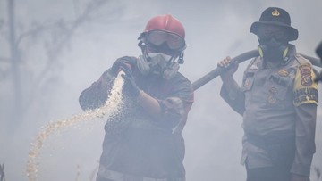
South Kalimantan is facing a severe risk of forest and land fires, as indicated by the Indonesian Meteorology, Climatology, and Geophysics Agency (BMKG). On Tuesday, the BMKG detected a significant number of 473 hotspots across 11 regencies and cities within the province. The most concerning concentrations of these hotspots were observed in Hulu Sungai Selatan, Tapin, and Banjar regencies.
Utari Randiana, a weather forecaster at the BMKG Syamsudin Noor Meteorological Station, reported that the data was compiled using the Kalimantan Hotspot Information System. While Banjarmasin and Balangan registered no hotspots, the majority of the detected hotspots, approximately 89.9 percent or 425, were classified as moderate. However, 32 were categorized as high and 16 as low, indicating a varied level of potential fire risk.
The BMKG has issued a stark warning, placing nearly all areas across the province's 13 regencies and cities into a "red zone." This designation signifies a very high level of risk for forest and land fires (karhutla). The hotspots with moderate confidence levels are spread across all 11 affected areas, while those with high confidence are concentrated in seven regencies, including Banjar, Barito Kuala, Hulu Sungai Selatan, Hulu Sungai Tengah, Tanah Bumbu, Tapin, and Banjarbaru City.
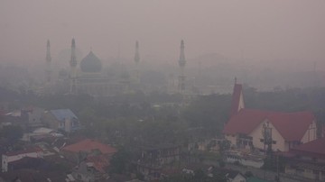
Hulu Sungai Selatan Regency recorded the highest number of hotspots with 118, followed by Tapin Regency with 102, and Banjar Regency with 99. These figures underscore the critical situation in these specific areas, which are particularly vulnerable to the escalating threat of fires. The concurrent haze affecting West Sumatra, originating from forest fires in neighboring provinces, further highlights the widespread and interconnected nature of this environmental crisis in the region.
Of the total 473 hotspots, 425 were classified as moderate, 32 as high, and 16 as low. The moderate category was the most dominant, accounting for approximately 89.9 percent of the total.
DistantNews Editorial
Originally published by Tempo. Summarized and contextualized by our editorial team with added local perspective. Read our editorial standards.
More Stories

From Our Blog

What Gets Lost (and Found) When News Is Translated

The Critical Role of Diaspora Media in Global News

What Travellers Should Know About Countries with Restricted Press

A Digital Nomad's Guide to Following Local News

How the Same Story Looks Different in Different Countries
