

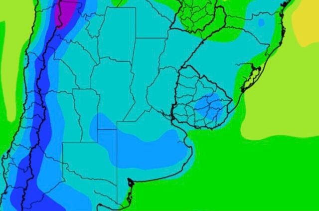

Argentina Braces for Intense Cold Front, Sharp Temperature Drop Expected
Translated from Spanish, summarized and contextualized by DistantNews.
TLDR
- A strong cold front is set to significantly alter weather conditions across central Argentina.
- The front will bring a sharp drop in temperatures, with polar air affecting Buenos Aires and surrounding areas.
- Expect a brief period of instability with isolated showers before the cold air mass fully settles in.
The central region of Argentina is bracing for a significant meteorological shift as a powerful cold front moves in, promising a dramatic change from the early week's mild temperatures. This incoming polar air mass is poised to directly impact the Buenos Aires metropolitan area and its environs, signaling a definitive end to the current milder weather.
According to Meteored, the week's most potent frontal system will sweep across the country's center on Friday. This will trigger an immediate shift in wind direction to the south in the AMBA. While a brief spell of atmospheric instability is anticipated, with a low probability of isolated showers during the day, temperatures will remain relatively mild before the cold truly takes hold. Maximums are expected to reach 24°C, with lows around 12°C, preceding the definitive arrival of the frigid air.
The full impact of the cold air will be felt over the weekend. Saturday will see partly cloudy skies and persistent wind gusts, characteristic of winter conditions. However, Sunday morning will bring the most intense cold, with temperatures in the city hovering between 7°C and 8°C. In the Greater Buenos Aires area, early morning lows could dip as low as 4°C. This marked thermal descent will firmly establish winter-like conditions across the capital and its surroundings.
DistantNews Editorial
Originally published by La Nación in Spanish. Translated, summarized, and contextualized by our editorial team with added local perspective. Read our editorial standards.
More Stories



From Our Blog

What Gets Lost (and Found) When News Is Translated

The Critical Role of Diaspora Media in Global News

What Travellers Should Know About Countries with Restricted Press

A Digital Nomad's Guide to Following Local News

How the Same Story Looks Different in Different Countries
